
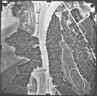
Photo Title
DVP-093
Preview
Flight Code
DVP
Date Flown
Summer 8-25-1975
Aerial Survey Project No. (A.S.P. No.)
75F-1
County
Blue Earth, Nicollet
Trunk Highway (T.H.)
14
Location
Mankato Bypass
Center Latitude
44°11'15.13"N
Center Longitude
94° 1'26.11"W
Scale
1''=250'
Flight Height
1500
Work Order No.
3
Agreement No.
57985
State Project No.
5203-43
Focal Length
153.13 mm
Physical Format
Black and White Physical Aerial Photograph
Dimensions
9 x 9
Item Type
Still Image
Collection Name
Minnesota Department of Transportation District 7 Air Photo Collection, 1957-2006
Contributing Organization
Dr. Mary T. Dooley Map Library, Memorial Library, Minnesota State University, Mankato, P.O. Box 8419, Mankato, MN 56002-8419
Contact Information
Dr. Mary T. Dooley Map Library, Memorial Library, Minnesota State University, Mankato, P.O. Box 8419, Mankato, MN 56002-8419
Creative Commons License

This work is licensed under a Creative Commons Attribution-NonCommercial 4.0 International License
Scanning Center
Dr. Mary T. Dooley Map Library, Memorial Library, Minnesota State University, Mankato, P.O. Box 8419, Mankato, MN 56002-8419
Object File Name
MnDOT_1975_75F-1_DVP-93.tif
Date Digital
2021-11-01
Item Digital Format
Image/tiff
Master File Format
Image/tiff
Master File Size
98718870
Master File Bit Depth
24
Master File Resolution
800 dpi
Master File Width
7509
Master File Height
7421
Master File Hardware
Epson Expression 10000XL
Master File Software
VueScan
Master File System
Windows 10
Master File Checksum
362c8a231f244e43b1209b5231d5a003
Keywords
mndot, air photos, aerial photography, 1975, north mankato, pond, road construction

