
Photo Title
DZQ-04
Preview
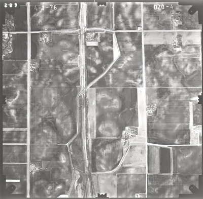
Flight Code
DZQ
Date Flown
Spring 4-1-1976
Aerial Survey Project No. (A.S.P. No.)
76S-14
County
Faribault
Trunk Highway (T.H.)
I-90
Location
From Co. Road 109 to 1 mi. E. of Co. Road 17
Center Latitude
43°39'14.76"N
Center Longitude
93°57'19.24"W
Scale
1''=1000'
Flight Height
6000
Work Order No.
48
Agreement No.
57995
State Project No.
2280-21
Focal Length
153.13 mm
Physical Format
Black and White Physical Aerial Photograph
Dimensions
9 x 9
Item Type
Still Image
Collection Name
Minnesota Department of Transportation District 7 Air Photo Collection, 1957-2006
Contributing Organization
Dr. Mary T. Dooley Map Library, Memorial Library, Minnesota State University, Mankato, P.O. Box 8419, Mankato, MN 56002-8419
Contact Information
Dr. Mary T. Dooley Map Library, Memorial Library, Minnesota State University, Mankato, P.O. Box 8419, Mankato, MN 56002-8419
Creative Commons License

This work is licensed under a Creative Commons Attribution-NonCommercial 4.0 International License
Scanning Center
Dr. Mary T. Dooley Map Library, Memorial Library, Minnesota State University, Mankato, P.O. Box 8419, Mankato, MN 56002-8419
Object File Name
MnDOT_1976_76S-14_DZQ-4.tif
Date Digital
2022-04-06
Item Digital Format
Image/tiff
Master File Format
Image/tiff
Master File Size
92016306
Master File Bit Depth
24
Master File Resolution
800 dpi
Master File Width
7520
Master File Height
7387
Master File Hardware
Epson Expression 10000XL
Master File Software
VueScan
Master File System
Windows 10
Master File Checksum
e4f27d3ab2d894db9383c5a622734951
Keywords
mndot, air photos, aerial photography, 1976, east branch blue earth river, ditch, stream, field tiling, road construction, possible wetland

