
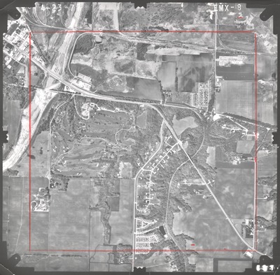
Photo Title
EMX-08a
Preview
Flight Code
EMX
Date Flown
Spring 4-23-1977
Aerial Survey Project No. (A.S.P. No.)
77S-43
County
Blue Earth
Trunk Highway (T.H.)
14, 22, 169, 60
Location
Mankato and Vicinity
Center Latitude
44°11'47.28"N
Center Longitude
93°58'25.02"W
Scale
1''=1000'
Flight Height
6000
Notes
Note on front includes hand-drawn orange area. Note on back reads "Please return to Lisa Bigham Dist 7."
Work Order No.
62
Agreement No.
58318
Focal Length
153.13 mm
Physical Format
Black and White Physical Aerial Photograph
Dimensions
9 x 9
Item Type
Still Image
Collection Name
Minnesota Department of Transportation District 7 Air Photo Collection, 1957-2006
Contributing Organization
Dr. Mary T. Dooley Map Library, Memorial Library, Minnesota State University, Mankato, P.O. Box 8419, Mankato, MN 56002-8419
Contact Information
Dr. Mary T. Dooley Map Library, Memorial Library, Minnesota State University, Mankato, P.O. Box 8419, Mankato, MN 56002-8419
Creative Commons License

This work is licensed under a Creative Commons Attribution-NonCommercial 4.0 International License
Scanning Center
Dr. Mary T. Dooley Map Library, Memorial Library, Minnesota State University, Mankato, P.O. Box 8419, Mankato, MN 56002-8419
Object File Name
MnDOT_1977_77S-43_EMX-8a.tif
Date Digital
2022-01-12
Item Digital Format
Image/tiff
Master File Format
Image/tiff
Master File Size
94342270
Master File Bit Depth
24
Master File Resolution
800 dpi
Master File Width
7531
Master File Height
7418
Master File Hardware
Epson Expression 10000XL
Master File Software
VueScan
Master File System
Windows 10
Master File Checksum
6f057674abc97cc5169d23586a33d8cf
Keywords
mndot, air photos, aerial photography, 1977, mankato, stream, sewage disposal pond, railroad, road construction

