

Preview
Photographer
Mark Hurd Aerial Surveys, Inc. Minneapolis, Minnesota
Description
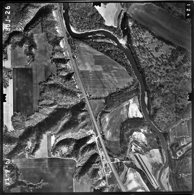
Aerial Photograph of the greater Mankato Area, Mankato, Minnesota from 1967.
Flight Code
BDJ
County Name
Blue Earth, Nicollet
Center Latitude
44°12'13.02"N
Center Longitude
94° 1'16.60"W
Date Flown
1967-11-09
Scale
1/10000
Physical Format
Black and White Aerial Photograph
Dimensions
9 x 9
Item Type
Still Image
Collection Name
1967 Greater Mankato Area Air Photos (BDJ)
Contributing Organization
University Archives and Southern Minnesota Historical Center, Memorial Library, Minnesota State University, Mankato, P.O. Box 8419, Mankato, MN 56002-8419
Contact Information
University Archives and Southern Minnesota Historical Center, Memorial Library, Minnesota State University, Mankato, P.O. Box 8419, Mankato, MN 56002-8419
Creative Commons License

This work is licensed under a Creative Commons Attribution-NonCommercial 4.0 International License
Scanning Center
University Archives and Southern Minnesota Historical Center, Memorial Library, Minnesota State University, Mankato, P.O. Box 8419, Mankato, MN 56002-8419
Object File Name
BDJ_26_022.tif
Date Digital
2014-10-16
Item Digital Format
Image/tiff
Master File Format
Image/tiff
Master File Size
111183726
Master File Bit Depth
16
Master File Resolution
800 dpi
Master File Width
7436
Master File Height
7476
Master File Hardware
Epson Expression 10000XL
Master File Software
EPSON Scan
Master File System
Windows 7
Master File Checksum
d004267576723e62d35fae3b84001648
Keywords
aerial photographs, air photos, Mankato, Minnesota, Blue Earth County, Nicollet County, 1967

