
Preview
Flight Code
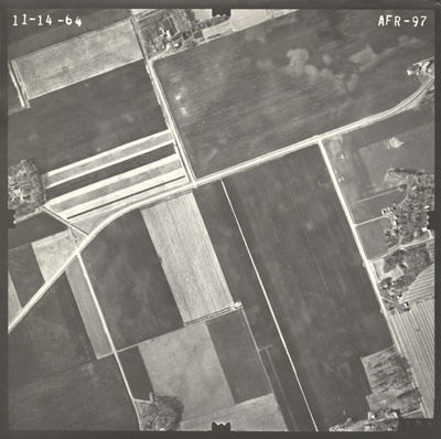
AFR
Date Flown
Fall 11-14-1964
Aerial Survey Project No. (A.S.P. No.)
64-8
County
Nicollet
Trunk Highway (T.H.)
14
Location
From Mankato to E. Co. Line
Center Latitude
44°11'17.21"N
Center Longitude
94° 2'14.22"W
Scale
1''=500'
Flight Height
3000
Work Order No.
13
Agreement No.
54101
Statewide Project No.
64
State Project No.
0702
Lens Serial Number
NR 2112
Focal Length
152.43 mm
Physical Format
Black and White Physical Aerial Photograph
Dimensions
9 x 9
Item Type
Still Image
Collection Name
Minnesota Department of Transportation District 7 Air Photo Collection, 1957-2006
Contributing Organization
Dr. Mary T. Dooley Map Library, Memorial Library, Minnesota State University, Mankato, P.O. Box 8419, Mankato, MN 56002-8419
Contact Information
Dr. Mary T. Dooley Map Library, Memorial Library, Minnesota State University, Mankato, P.O. Box 8419, Mankato, MN 56002-8419
Creative Commons License

This work is licensed under a Creative Commons Attribution-NonCommercial 4.0 International License
Scanning Center
Dr. Mary T. Dooley Map Library, Memorial Library, Minnesota State University, Mankato, P.O. Box 8419, Mankato, MN 56002-8419
Object File Name
MnDOT_1964_64-8_AFR-97.tif
Date Digital
2021-05-05
Item Digital Format
Image/tiff
Master File Format
Image/tiff
Master File Size
98259720
Master File Bit Depth
24
Master File Resolution
800 dpi
Master File Width
7600
Master File Height
7561
Master File Hardware
Epson Expression 10000XL
Master File Software
VueScan
Master File System
Windows 10
Master File Checksum
f09cfbe11e7a7eabf43fe9696e3b3128
Keywords
mndot, air photos, aerial photography, 1964

