
Preview
Flight Code
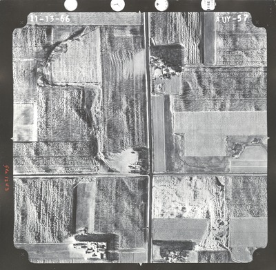
AUY
Date Flown
Fall 11-13-1966
Aerial Survey Project No. (A.S.P. No.)
66F-19
County
Watonwan
Trunk Highway (T.H.)
60
Location
E. of Butterfield to S. Jct. TH 15
Center Latitude
43°57'52.35"N
Center Longitude
94°40'54.33"W
Scale
1''=500'
Flight Height
3000
Notes
Note on front reads "Sta 1243."
Work Order No.
61
Agreement No.
54679
Statewide Project No.
65
State Project No.
8308, 8309
Lens Serial Number
UAG 245
Focal Length
152.22 mm
Physical Format
Black and White Physical Aerial Photograph
Dimensions
9 x 9
Item Type
Still Image
Collection Name
Minnesota Department of Transportation District 7 Air Photo Collection, 1957-2006
Contributing Organization
Dr. Mary T. Dooley Map Library, Memorial Library, Minnesota State University, Mankato, P.O. Box 8419, Mankato, MN 56002-8419
Contact Information
Dr. Mary T. Dooley Map Library, Memorial Library, Minnesota State University, Mankato, P.O. Box 8419, Mankato, MN 56002-8419
Creative Commons License

This work is licensed under a Creative Commons Attribution-NonCommercial 4.0 International License
Scanning Center
Dr. Mary T. Dooley Map Library, Memorial Library, Minnesota State University, Mankato, P.O. Box 8419, Mankato, MN 56002-8419
Object File Name
MnDOT_1966_66F-19_AUY-57.tif
Date Digital
2021-05-14
Item Digital Format
Image/tiff
Master File Format
Image/tiff
Master File Size
127270638
Master File Bit Depth
24
Master File Resolution
800 dpi
Master File Width
7936
Master File Height
7751
Master File Hardware
Epson Expression 10000XL
Master File Software
VueScan
Master File System
Windows 10
Master File Checksum
242c069dbc6bbe247d7c93a0a29a2e31
Keywords
mndot, air photos, aerial photography, 1966, stream, flight instruments

