
Preview
Flight Code
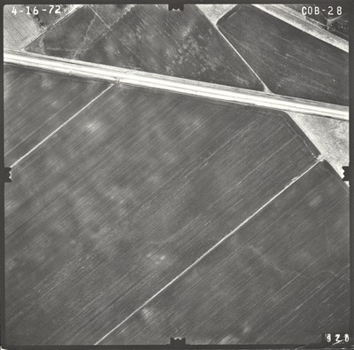
COB
Date Flown
Spring 4-16-1972
Aerial Survey Project No. (A.S.P. No.)
72S-35
County
Watonwan
Trunk Highway (T.H.)
15
Location
Madelia Bypass
Center Latitude
44° 3'20.51"N
Center Longitude
94°24'7.20"W
Scale
1''=250'
Flight Height
1500
Work Order No.
38
Agreement No.
56854
State Project No.
8305
Focal Length
152.36 mm
Physical Format
Black and White Physical Aerial Photograph
Dimensions
9 x 9
Item Type
Still Image
Collection Name
Minnesota Department of Transportation District 7 Air Photo Collection, 1957-2006
Contributing Organization
Dr. Mary T. Dooley Map Library, Memorial Library, Minnesota State University, Mankato, P.O. Box 8419, Mankato, MN 56002-8419
Contact Information
Dr. Mary T. Dooley Map Library, Memorial Library, Minnesota State University, Mankato, P.O. Box 8419, Mankato, MN 56002-8419
Creative Commons License

This work is licensed under a Creative Commons Attribution-NonCommercial 4.0 International License
Scanning Center
Dr. Mary T. Dooley Map Library, Memorial Library, Minnesota State University, Mankato, P.O. Box 8419, Mankato, MN 56002-8419
Object File Name
MnDOT_1972_72S-35_COB-28.tif
Date Digital
2021-09-11
Item Digital Format
Image/tiff
Master File Format
Image/tiff
Master File Size
97872652
Master File Bit Depth
24
Master File Resolution
800 dpi
Master File Width
7573
Master File Height
7487
Master File Hardware
Epson Expression 10000XL
Master File Software
VueScan
Master File System
Windows 10
Master File Checksum
895695a19e02436d778436de6086426e
Keywords
mndot, air photos, aerial photography, 1972, railroad

