
Preview
Flight Code
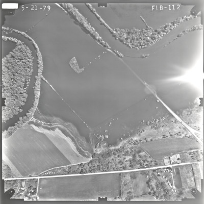
FIB
Date Flown
Spring 5-21-1979
Aerial Survey Project No. (A.S.P. No.)
79S-7
County
Brown, Nicollet
Trunk Highway (T.H.)
14
Location
New Ulm Bypass
Center Latitude
44°20'59.69"N
Center Longitude
94°29'41.87"W
Scale
1’’=400’
Flight Height
2400
Work Order No.
44
Agreement No.
59194
State Project No.
0804-44
Lens Serial Number
98183
Focal Length
152.465 mm
Physical Format
Black and White Physical Aerial Photograph
Dimensions
9 x 9
Item Type
Still Image
Collection Name
Minnesota Department of Transportation District 7 Air Photo Collection, 1957-2006
Contributing Organization
Dr. Mary T. Dooley Map Library, Memorial Library, Minnesota State University, Mankato, P.O. Box 8419, Mankato, MN 56002-8419
Contact Information
Dr. Mary T. Dooley Map Library, Memorial Library, Minnesota State University, Mankato, P.O. Box 8419, Mankato, MN 56002-8419
Creative Commons License

This work is licensed under a Creative Commons Attribution-NonCommercial 4.0 International License
Scanning Center
Dr. Mary T. Dooley Map Library, Memorial Library, Minnesota State University, Mankato, P.O. Box 8419, Mankato, MN 56002-8419
Object File Name
MnDOT_1979_79S-7_FIB-112.tif
Date Digital
2022-08-22
Item Digital Format
Image/tiff
Master File Format
Image/tiff
Master File Size
90390028
Master File Bit Depth
24
Master File Resolution
800 dpi
Master File Width
7499
Master File Height
7491
Master File Hardware
Epson Expression 10000XL
Master File Software
VueScan
Master File System
Windows 10
Master File Checksum
d7dd969b22252a61a722843a8bb88529
Keywords
mndot, air photos, aerial photography, 1979, new ulm, minnesota river, wetland

