
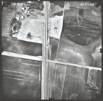
Preview
Flight Code
KCT
Date Flown
Spring 4-5-1987
Aerial Survey Project No. (A.S.P. No.)
87S-25
County
Nicollet
Trunk Highway (T.H.)
14
Location
From Minnesota River at New Ulm to Lookout Drive (Old TH 14) in North Mankato
Center Latitude
44°16'4.30"N
Center Longitude
94°16'38.71"W
Scale
1''=250'
Flight Height
1500
Work Order No.
44
Agreement No.
63683
State Project No.
5202-37, 5203-73
Camera
Camera No. 21214
Lens Serial Number
98177
Focal Length
152.340 mm
Physical Format
Black and White Physical Aerial Photograph
Dimensions
9 x 9
Item Type
Still Image
Collection Name
Minnesota Department of Transportation District 7 Air Photo Collection, 1957-2006
Contributing Organization
Dr. Mary T. Dooley Map Library, Memorial Library, Minnesota State University, Mankato, P.O. Box 8419, Mankato, MN 56002-8419
Contact Information
Dr. Mary T. Dooley Map Library, Memorial Library, Minnesota State University, Mankato, P.O. Box 8419, Mankato, MN 56002-8419
Creative Commons License

This work is licensed under a Creative Commons Attribution-NonCommercial 4.0 International License
Scanning Center
Dr. Mary T. Dooley Map Library, Memorial Library, Minnesota State University, Mankato, P.O. Box 8419, Mankato, MN 56002-8419
Object File Name
MnDOT_1987_87S-25_KCT-148.tif
Date Digital
2023-04-21
Item Digital Format
Image/tiff
Master File Format
Image/tiff
Master File Size
102179912
Master File Bit Depth
24
Master File Resolution
800 dpi
Master File Width
7584
Master File Height
7419
Master File Hardware
Epson Expression 10000XL
Master File Software
VueScan
Master File System
Windows 10
Master File Checksum
c58e72621ae78d43d64462740acc316a
Keywords
mndot, air photos, aerial photography, 1987, marsh, field tiling

