

Preview
Date Flown
Spring 4-21-2000
Job No.
0-7233
County
Blue Earth
Location
Lyra Twp [Township] Bridge
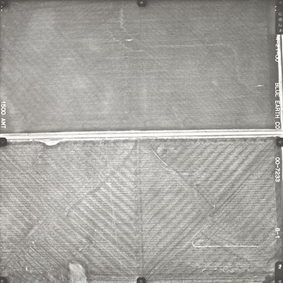
Description
2000 aerial photography of the Lyra Township Bridge and County State-Aid Highway (CSAH) 10 commissioned by Blue Earth County Public Works.
Center Latitude
43.978246
Center Longitude
-94.083946
Scale
1''=250'
Flight Height
1500
Camera
Zeiss RMK Top 15
Camera Serial Number
144123
Lens Serial Number
[143105]
Focal Length
[153 mm]
Frame Orientation
Vertical
Physical Format
Black and White Physical Aerial Photograph
Dimensions
9 x 9
Item Type
Still Image
Collection Name
Blue Earth County Public Works Air Photo Collection
Contributing Organization
Dr. Mary T. Dooley Map Library, Memorial Library, Minnesota State University, Mankato, P.O. Box 8419, Mankato, MN 56002-8419
Contact Information
Dr. Mary T. Dooley Map Library, Memorial Library, Minnesota State University, Mankato, P.O. Box 8419, Mankato, MN 56002-8419
Creative Commons License

This work is licensed under a Creative Commons Attribution-NonCommercial 4.0 International License
Scanning Center
Dr. Mary T. Dooley Map Library, Memorial Library, Minnesota State University, Mankato, P.O. Box 8419, Mankato, MN 56002-8419
Object File Name
BECPW_2000_0-7233_8-01.tif
Date Digital
2026-04-02
Item Digital Format
Image/tiff
Master File Format
Image/tiff
Master File Size
120783582
Master File Bit Depth
24
Master File Resolution
800 dpi
Master File Width
7247
Master File Height
7224
Master File Hardware
Epson Expression 12000XL
Master File Software
VueScan
Master File System
Windows 11
Master File Checksum
15e359c49a1df3a36919fabd4d0b6bc5
Keywords
blue earth county public works, air photos, aerial photography, 2000, field tiling, wetland

