

Preview
Date Flown
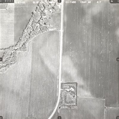
Spring 5-7-2001
Job No.
01-7480
County
Nicollet
Location
CSAH 42
Description
2001 aerial photography of County State-Aid Highway (CSAH) 26 and CSAH 42 and Judson commissioned by Blue Earth County Public Works.
Center Latitude
44.206476
Center Longitude
-94.190304
Scale
1''=300'
Flight Height
1800
Notes
Handwritten note on photo sleeve reads "Judson."
Camera
Zeiss RMK Top 15
Camera Serial Number
145848
Lens Serial Number
[145897]
Focal Length
[153 mm]
Frame Orientation
Vertical
Physical Format
Black and White Physical Aerial Photograph
Dimensions
9 x 9
Item Type
Still Image
Collection Name
Blue Earth County Public Works Air Photo Collection
Contributing Organization
Dr. Mary T. Dooley Map Library, Memorial Library, Minnesota State University, Mankato, P.O. Box 8419, Mankato, MN 56002-8419
Contact Information
Dr. Mary T. Dooley Map Library, Memorial Library, Minnesota State University, Mankato, P.O. Box 8419, Mankato, MN 56002-8419
Creative Commons License

This work is licensed under a Creative Commons Attribution-NonCommercial 4.0 International License
Scanning Center
Dr. Mary T. Dooley Map Library, Memorial Library, Minnesota State University, Mankato, P.O. Box 8419, Mankato, MN 56002-8419
Object File Name
BECPW_2001_01-7480_4-07.tif
Date Digital
2026-04-09
Item Digital Format
Image/tiff
Master File Format
Image/tiff
Master File Size
116600472
Master File Bit Depth
24
Master File Resolution
800 dpi
Master File Width
7219
Master File Height
7225
Master File Hardware
Epson Expression 12000XL
Master File Software
VueScan
Master File System
Windows 11
Master File Checksum
fd5c7198f4a1b08a54386ede2ab613d7
Keywords
blue earth county public works, air photos, aerial photography, 2001, swan lake outlet, field tiling, wetland

