

Preview
Date Flown
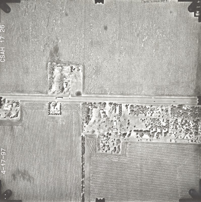
Spring 4-17-1997
Job No.
7-8452
County
Blue Earth
Location
CSAH 17
Description
1997 aerial photography of County State-Aid Highways (CSAH) 17 and 20.
Center Latitude
44.166917
Center Longitude
-93.923075
Scale
1''=250'
Flight Height
1500
Camera
[Zeiss RMK-A 15/23]
Camera Serial Number
[137473]
Lens Serial Number
137503
Focal Length
153.72 mm
Frame Orientation
Vertical
Physical Format
Black and White Physical Aerial Photograph
Dimensions
9 x 9
Item Type
Still Image
Collection Name
Blue Earth County Public Works Air Photo Collection
Contributing Organization
Dr. Mary T. Dooley Map Library, Memorial Library, Minnesota State University, Mankato, P.O. Box 8419, Mankato, MN 56002-8419
Contact Information
Dr. Mary T. Dooley Map Library, Memorial Library, Minnesota State University, Mankato, P.O. Box 8419, Mankato, MN 56002-8419
Creative Commons License

This work is licensed under a Creative Commons Attribution-NonCommercial 4.0 International License
Scanning Center
Dr. Mary T. Dooley Map Library, Memorial Library, Minnesota State University, Mankato, P.O. Box 8419, Mankato, MN 56002-8419
Object File Name
BECPW_1997_7-8452_CSAH17-26.tif
Date Digital
2026-04-13
Item Digital Format
Image/tiff
Master File Format
Image/tiff
Master File Size
124249854
Master File Bit Depth
24
Master File Resolution
800 dpi
Master File Width
7208
Master File Height
7242
Master File Hardware
Epson Expression 12000XL
Master File Software
VueScan
Master File System
Windows 11
Master File Checksum
ebbe4cf574c5f9a569177ae9924d639b
Keywords
blue earth county public works, air photos, aerial photography, 1997, field tiling

