

Preview
Date Flown
Spring 4-6-2003
Job No.
70650
County
Blue Earth, Le Sueur
Location
CSAH 12
Description
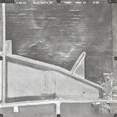
2003 aerial photography of County State-Aid Highway (CSAH) 12 commissioned by Blue Earth County Public Works.
Center Latitude
44.242648
Center Longitude
-93.929142
Scale
1''=300'
Flight Height
1800
Camera
Zeiss RMK Top 15
Camera Serial Number
144123
Lens Serial Number
[143105]
Focal Length
152.773 mm
Frame Orientation
Vertical
Physical Format
Black and White Physical Aerial Photograph
Dimensions
9 x 9
Item Type
Still Image
Collection Name
Blue Earth County Public Works Air Photo Collection
Contributing Organization
Dr. Mary T. Dooley Map Library, Memorial Library, Minnesota State University, Mankato, P.O. Box 8419, Mankato, MN 56002-8419
Contact Information
Dr. Mary T. Dooley Map Library, Memorial Library, Minnesota State University, Mankato, P.O. Box 8419, Mankato, MN 56002-8419
Creative Commons License

This work is licensed under a Creative Commons Attribution-NonCommercial 4.0 International License
Scanning Center
Dr. Mary T. Dooley Map Library, Memorial Library, Minnesota State University, Mankato, P.O. Box 8419, Mankato, MN 56002-8419
Object File Name
BECPW_2003_70650_2-20.tif
Date Digital
2026-04-01
Item Digital Format
Image/tiff
Master File Format
Image/tiff
Master File Size
121078978
Master File Bit Depth
24
Master File Resolution
800 dpi
Master File Width
7248
Master File Height
7241
Master File Hardware
Epson Expression 12000XL
Master File Software
VueScan
Master File System
Windows 11
Master File Checksum
73be688f7d81db5c8de84145198ebad8
Keywords
blue earth county public works, air photos, aerial photography, 2003, ditch, marsh, field tiling, culvert, wetland

