

Preview
Date Flown
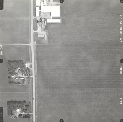
Spring 4-6-2004
Job No.
71036
County
Blue Earth
Location
County Road 147
Description
2004 aerial photography of County Road 147 commissioned by Blue Earth County Public Works.
Center Latitude
43.879460
Center Longitude
-94.166255
Scale
1''=300'
Flight Height
1800
Camera
Zeiss RMK Top 15
Camera Serial Number
151961
Lens Serial Number
[151892]
Focal Length
[153 mm]
Frame Orientation
Vertical
Physical Format
Black and White Physical Aerial Photograph
Dimensions
9 x 9
Item Type
Still Image
Collection Name
Blue Earth County Public Works Air Photo Collection
Contributing Organization
Dr. Mary T. Dooley Map Library, Memorial Library, Minnesota State University, Mankato, P.O. Box 8419, Mankato, MN 56002-8419
Contact Information
Dr. Mary T. Dooley Map Library, Memorial Library, Minnesota State University, Mankato, P.O. Box 8419, Mankato, MN 56002-8419
Creative Commons License

This work is licensed under a Creative Commons Attribution-NonCommercial 4.0 International License
Scanning Center
Dr. Mary T. Dooley Map Library, Memorial Library, Minnesota State University, Mankato, P.O. Box 8419, Mankato, MN 56002-8419
Object File Name
BECPW_2004_71036_1-10.tif
Date Digital
2026-03-31
Item Digital Format
Image/tiff
Master File Format
Image/tiff
Master File Size
89484958
Master File Bit Depth
24
Master File Resolution
800 dpi
Master File Width
7252
Master File Height
7235
Master File Hardware
Epson Expression 12000XL
Master File Software
VueScan
Master File System
Windows 11
Master File Checksum
a2c8432f7df2e3328b06415fcd007917
Keywords
blue earth county public works, air photos, aerial photography, 2004, field tiling, grain elevator

