

Preview
Date Flown
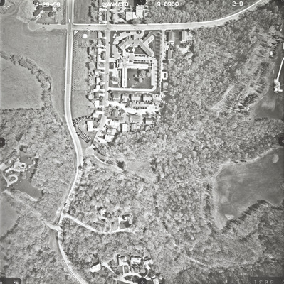
Spring 4-29-1999
Job No.
9-8980
County
Blue Earth
Location
CSAH 16
Description
1999 aerial photography of County State-Aid Highway (CSAH) 16 and Mankato commissioned by Blue Earth County Public Works.
Center Latitude
44.141240
Center Longitude
-94.006249
Scale
1''=250'
Flight Height
1500
Camera
Zeiss RMK Top 15
Camera Serial Number
144123
Lens Serial Number
[143105]
Focal Length
[153 mm]
Frame Orientation
Vertical
Physical Format
Black and White Physical Aerial Photograph
Dimensions
9 x 9
Item Type
Still Image
Collection Name
Blue Earth County Public Works Air Photo Collection
Contributing Organization
Dr. Mary T. Dooley Map Library, Memorial Library, Minnesota State University, Mankato, P.O. Box 8419, Mankato, MN 56002-8419
Contact Information
Dr. Mary T. Dooley Map Library, Memorial Library, Minnesota State University, Mankato, P.O. Box 8419, Mankato, MN 56002-8419
Creative Commons License

This work is licensed under a Creative Commons Attribution-NonCommercial 4.0 International License
Scanning Center
Dr. Mary T. Dooley Map Library, Memorial Library, Minnesota State University, Mankato, P.O. Box 8419, Mankato, MN 56002-8419
Object File Name
BECPW_1999_9-8980_2-09.tif
Date Digital
2026-04-23
Item Digital Format
Image/tiff
Master File Format
Image/tiff
Master File Size
113182442
Master File Bit Depth
24
Master File Resolution
800 dpi
Master File Width
7160
Master File Height
7171
Master File Hardware
Epson Expression 12000XL
Master File Software
VueScan
Master File System
Windows 11
Master File Checksum
6ecd203cc7301856f70a17c3dea6a060
Keywords
blue earth county public works, air photos, aerial photography, 1999, mankato, stream, field tiling, wetland

