

Preview
Date Flown
Spring 5-3-1992
Job No.
92-5-3
County
Blue Earth
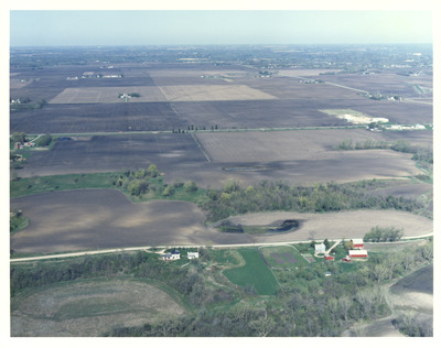
Description
1992 aerial photography [of the proposed south route for the County State-Aid Highway (CSAH) 90 project] commissioned by Blue Earth County Public Works.
Center Latitude
44.115154
Center Longitude
-93.946582
Notes
Handwritten note on the back reads "#20."
Frame Orientation
Oblique
Physical Format
Color Physical Aerial Photograph
Dimensions
4.5 x 5.875
Item Type
Still Image
Collection Name
Blue Earth County Public Works Air Photo Collection
Contributing Organization
Dr. Mary T. Dooley Map Library, Memorial Library, Minnesota State University, Mankato, P.O. Box 8419, Mankato, MN 56002-8419
Contact Information
Dr. Mary T. Dooley Map Library, Memorial Library, Minnesota State University, Mankato, P.O. Box 8419, Mankato, MN 56002-8419
Creative Commons License

This work is licensed under a Creative Commons Attribution-NonCommercial 4.0 International License
Scanning Center
Dr. Mary T. Dooley Map Library, Memorial Library, Minnesota State University, Mankato, P.O. Box 8419, Mankato, MN 56002-8419
Object File Name
BECPW_1992_92-5-3-027.tif
Date Digital
2026-04-16
Item Digital Format
Image/tiff
Master File Format
Image/tiff
Master File Size
29094480
Master File Bit Depth
24
Master File Resolution
800 dpi
Master File Width
4954
Master File Height
3916
Master File Hardware
Epson Expression 12000XL
Master File Software
VueScan
Master File System
Windows 11
Master File Checksum
6ec2d85cce2fd30b8c6f80dbac5610b8
Keywords
blue earth county public works, air photos, aerial photography, 1992, field tiling, wetland

