

Preview
Flight Code
LDS
Date Flown
Spring 4-10-1989
Job No.
Not Available
County
Blue Earth
Location
County Road 174
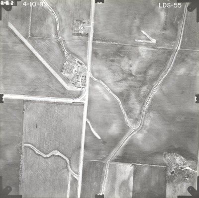
Description
1989 aerial photography of County Road 174 between County State-Aid Highway (CSAH) 10 to County Road 177 commissioned by Blue Earth County Public Works.
Center Latitude
44.065632
Center Longitude
-93.887271
Frame Orientation
Vertical
Physical Format
Black and White Physical Aerial Photograph
Dimensions
9 x 9
Item Type
Still Image
Collection Name
Blue Earth County Public Works Air Photo Collection
Contributing Organization
Dr. Mary T. Dooley Map Library, Memorial Library, Minnesota State University, Mankato, P.O. Box 8419, Mankato, MN 56002-8419
Contact Information
Dr. Mary T. Dooley Map Library, Memorial Library, Minnesota State University, Mankato, P.O. Box 8419, Mankato, MN 56002-8419
Creative Commons License

This work is licensed under a Creative Commons Attribution-NonCommercial 4.0 International License
Scanning Center
Dr. Mary T. Dooley Map Library, Memorial Library, Minnesota State University, Mankato, P.O. Box 8419, Mankato, MN 56002-8419
Object File Name
BECPW_1989_LDS-55.tif
Date Digital
2026-04-06
Item Digital Format
Image/tiff
Master File Format
Image/tiff
Master File Size
99165230
Master File Bit Depth
24
Master File Resolution
800 dpi
Master File Width
7252
Master File Height
7231
Master File Hardware
Epson Expression 12000XL
Master File Software
VueScan
Master File System
Windows 11
Master File Checksum
1a3c6ee2c012f9d4e94b12cc76147ed3
Keywords
blue earth county public works, air photos, aerial photography, 1989, ditch, stream, field tiling, culvert, wetland

