

Preview
Creator
State Drainage Commission, St. Paul, Minnesota
Publisher
U.S. Geological Survey (Washington, D.C.)
Year(s) Surveyed
1911
Scale
1:12000
Coordinates
(W 96°02'14"-W 95°55'56"/N 47°19'04"-N 47°17'13")
Notes
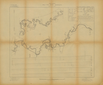
Printed note on map reads "Note: Water elevations on plan and profile refer to stage of river corresponding to a reading of 4.6 feet on the Twin Valley gage. The survey below the bridge near (53) sheets 5 to 8 inclusive was compiled from a drainage survey made under the direction of George A. Ralph, Chief Engineer of the State Drainage Commission. Section corners on sheets 1 to 4 were located chiefly from Land Office plats."
Description
1909-1912 Minnesota river maps and profiles from the Minnesota State Drainage Commission in cooperation with the USGS.
Physical Format
Map
Dimensions
46 x 56.1 cm
Item Type
Cartographic
Collection Name
Minnesota River Surveys, 1909-1912
Contributing Organization
Dr. Mary T. Dooley Map Library, Memorial Library, Minnesota State University, Mankato, P.O. Box 8419, Mankato, MN 56002-8419
Contact Information
Dr. Mary T. Dooley Map Library, Memorial Library, Minnesota State University, Mankato, P.O. Box 8419, Mankato, MN 56002-8419
Creative Commons License

This work is licensed under a Creative Commons Attribution-NonCommercial 4.0 International License
Scanning Center
Dr. Mary T. Dooley Map Library, Memorial Library, Minnesota State University, Mankato, P.O. Box 8419, Mankato, MN 56002-8419
Object File Name
MNRiverSurveys_Vol2_Plate87WildRiceRiverSheet1.tif
Date Digital
2025-01-03
Item Digital Format
Image/tiff
Master File Format
Image/tiff
Master File Size
426563152
Master File Bit Depth
24
Master File Resolution
600 dpi
Master File Width
13140
Master File Height
10804
Master File Hardware
Zeutschel OS C1
Master File Software
OmniScan Software OS12
Master File System
Windows 11
Master File Checksum
93e2bb5a14923399bdc836c54b54d8fe
Keywords
mn river surveys, minnesota state drainage commission, usgs, maps, 1911, wild rice river

