

Preview
Creator
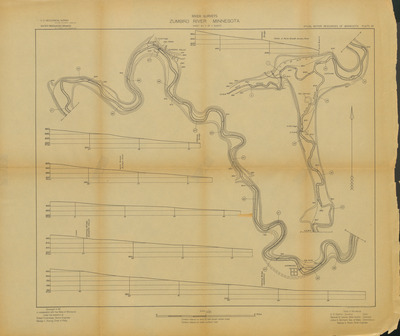
State Drainage Commission, St. Paul, Minnesota
Publisher
U.S. Geological Survey (Washington, D.C.)
Year(s) Surveyed
1911
Scale
1:24000
Coordinates
(W 92°30'19"-W 92°21'08"/N 44°18'49"-N 44°12'40")
Description
1909-1912 Minnesota river maps and profiles from the Minnesota State Drainage Commission in cooperation with the USGS.
Physical Format
Map
Dimensions
45.8 x 54.7 cm
Item Type
Cartographic
Collection Name
Minnesota River Surveys, 1909-1912
Contributing Organization
Dr. Mary T. Dooley Map Library, Memorial Library, Minnesota State University, Mankato, P.O. Box 8419, Mankato, MN 56002-8419
Contact Information
Dr. Mary T. Dooley Map Library, Memorial Library, Minnesota State University, Mankato, P.O. Box 8419, Mankato, MN 56002-8419
Creative Commons License

This work is licensed under a Creative Commons Attribution-NonCommercial 4.0 International License
Scanning Center
Dr. Mary T. Dooley Map Library, Memorial Library, Minnesota State University, Mankato, P.O. Box 8419, Mankato, MN 56002-8419
Object File Name
MNRiverSurveys_Vol2_Plate97ZumbroRiverSheet3.tif
Date Digital
2025-01-03
Item Digital Format
Image/tiff
Master File Format
Image/tiff
Master File Size
414735991
Master File Bit Depth
24
Master File Resolution
600 dpi
Master File Width
12819
Master File Height
10767
Master File Hardware
Zeutschel OS C1
Master File Software
OmniScan Software OS12
Master File System
Windows 11
Master File Checksum
10b4a1dabc149b2231ca105ef86fe5db
Keywords
mn river surveys, minnesota state drainage commission, usgs, maps, 1911, zumbro river

