

Preview
Creator
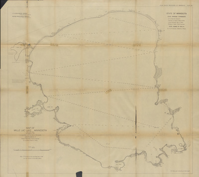
State Drainage Commission, St. Paul, Minnesota
Publisher
U.S. Geological Survey (Washington, D.C.)
Year(s) Surveyed
1909
Scale
1:36000
Coordinates
(W 93°52'41"-W 93°27'21"/N 46°22'20"-N 46°06'17")
Notes
Printed note on map reads "Note: All elevations and soundings are in feet and are referred to low water datum."
Description
1909-1912 Minnesota river maps and profiles from the Minnesota State Drainage Commission in cooperation with the USGS.
Physical Format
Map
Dimensions
91.7 x 101.7 cm
Item Type
Cartographic
Collection Name
Minnesota River Surveys, 1909-1912
Contributing Organization
Dr. Mary T. Dooley Map Library, Memorial Library, Minnesota State University, Mankato, P.O. Box 8419, Mankato, MN 56002-8419
Contact Information
Dr. Mary T. Dooley Map Library, Memorial Library, Minnesota State University, Mankato, P.O. Box 8419, Mankato, MN 56002-8419
Creative Commons License

This work is licensed under a Creative Commons Attribution-NonCommercial 4.0 International License
Scanning Center
Dr. Mary T. Dooley Map Library, Memorial Library, Minnesota State University, Mankato, P.O. Box 8419, Mankato, MN 56002-8419
Object File Name
MNRiverSurveys_Vol2_Plate38MilleLacLakeSheet1.tif
Date Digital
2025-02-26
Item Digital Format
Image/tiff
Master File Format
Image/tiff
Master File Size
1520075992
Master File Bit Depth
24
Master File Resolution
600 dpi
Master File Width
23847
Master File Height
21235
Master File Hardware
Zeutschel OS C1
Master File Software
OmniScan Software OS12
Master File System
Windows 11
Master File Checksum
50a700559e31f102e9e97cfaed83627c
Keywords
mn river surveys, minnesota state drainage commission, usgs, maps, 1909, mille lac lake

