

Preview
Creator
State Drainage Commission, St. Paul, Minnesota
Publisher
U.S. Geological Survey (Washington, D.C.)
Year(s) Surveyed
1911
Scale
1:36000
Coordinates
(W 95°17'54"-W 94°43'11"/N 48°05'52"-N 47°51'49")
Notes
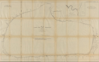
Printed note on map reads "Note: Contour interval is 5 feet except where noted. All elevations and soundings are in feet and are referred to low water datum of 1911. The elevation of water surface in September 1911 was 1174.5. Section Corners were located chiefly from Land Office plats."
Description
1909-1912 Minnesota river maps and profiles from the Minnesota State Drainage Commission in cooperation with the USGS.
Physical Format
Map
Dimensions
77.7 x 127 cm
Item Type
Cartographic
Collection Name
Minnesota River Surveys, 1909-1912
Contributing Organization
Dr. Mary T. Dooley Map Library, Memorial Library, Minnesota State University, Mankato, P.O. Box 8419, Mankato, MN 56002-8419
Contact Information
Dr. Mary T. Dooley Map Library, Memorial Library, Minnesota State University, Mankato, P.O. Box 8419, Mankato, MN 56002-8419
Creative Commons License

This work is licensed under a Creative Commons Attribution-NonCommercial 4.0 International License
Scanning Center
Dr. Mary T. Dooley Map Library, Memorial Library, Minnesota State University, Mankato, P.O. Box 8419, Mankato, MN 56002-8419
Object File Name
MNRiverSurveys_Vol2_Plate56LowerRedLakeSheet1.tif
Date Digital
2025-02-26
Item Digital Format
Image/tiff
Master File Format
Image/tiff
Master File Size
1559016296
Master File Bit Depth
24
Master File Resolution
600 dpi
Master File Width
28659
Master File Height
18122
Master File Hardware
Zeutschel OS C1
Master File Software
OmniScan Software OS12
Master File System
Windows 11
Master File Checksum
7e072ec578a4ba1cb4d5d06c6ae058be
Keywords
mn river surveys, minnesota state drainage commission, usgs, maps, 1911, lower red lake

