

Preview
Flight Code
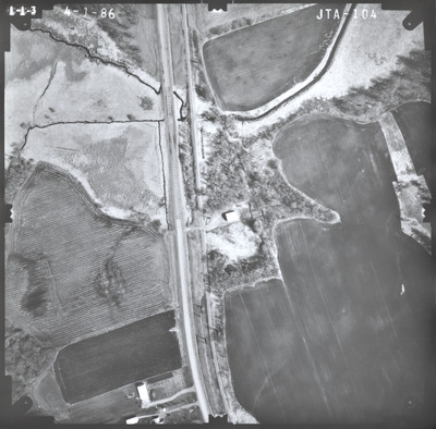
JTA
Date Flown
Spring 4-1-1986
Aerial Survey Project No. (A.S.P. No.)
86S-28
County
Le Sueur
Trunk Highway (T.H.)
13
Location
From Jct. TH 99 to West Jct. TH 19 in New Prague
Center Latitude
44°27'42.90"N
Center Longitude
93°35'9.26"W
Scale
1''=250'
Flight Height
1500
Work Order No.
34
Agreement No.
62947
State Project No.
4002
Lens Serial Number
118991
Focal Length
153.124 mm
Physical Format
Black and White Physical Aerial Photograph
Dimensions
9 x 9
Item Type
Still Image
Collection Name
Minnesota Department of Transportation District 7 Air Photo Collection, 1957-2006
Contributing Organization
Dr. Mary T. Dooley Map Library, Memorial Library, Minnesota State University, Mankato, P.O. Box 8419, Mankato, MN 56002-8419
Contact Information
Dr. Mary T. Dooley Map Library, Memorial Library, Minnesota State University, Mankato, P.O. Box 8419, Mankato, MN 56002-8419
Creative Commons License

This work is licensed under a Creative Commons Attribution-NonCommercial 4.0 International License
Scanning Center
Dr. Mary T. Dooley Map Library, Memorial Library, Minnesota State University, Mankato, P.O. Box 8419, Mankato, MN 56002-8419
Object File Name
MnDOT_1986_86S-28_JTA-104.tif
Date Digital
2023-06-26
Item Digital Format
Image/tiff
Master File Format
Image/tiff
Master File Size
95818324
Master File Bit Depth
24
Master File Resolution
800 dpi
Master File Width
7544
Master File Height
7423
Master File Hardware
Epson Expression 12000XL
Master File Software
VueScan
Master File System
Windows 10
Master File Checksum
ad2a56ad368f21ddd712141fad97d2fc
Keywords
mndot, air photos, aerial photography, 1986, ditch, stream, marsh, railroad, field tiling, wetland

