

Preview
Flight Code
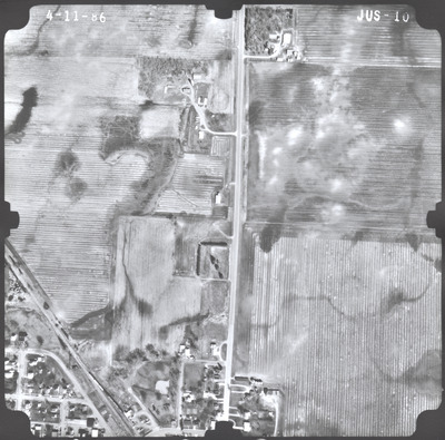
JUS
Date Flown
Spring 4-11-1986
Aerial Survey Project No. (A.S.P. No.)
86S-34
County
Brown
Trunk Highway (T.H.)
258
Location
Comfrey to Jct. TH 14
Center Latitude
44° 6'53.86"N
Center Longitude
94°54'0.19"W
Scale
1’’=400’
Flight Height
2400
Work Order No.
34
Agreement No.
62947
State Project No.
0809
Camera
Camera No. 577
Lens Serial Number
UAG 245
Focal Length
152.228 mm
Physical Format
Black and White Physical Aerial Photograph
Dimensions
9 x 9
Item Type
Still Image
Collection Name
Minnesota Department of Transportation District 7 Air Photo Collection, 1957-2006
Contributing Organization
Dr. Mary T. Dooley Map Library, Memorial Library, Minnesota State University, Mankato, P.O. Box 8419, Mankato, MN 56002-8419
Contact Information
Dr. Mary T. Dooley Map Library, Memorial Library, Minnesota State University, Mankato, P.O. Box 8419, Mankato, MN 56002-8419
Creative Commons License

This work is licensed under a Creative Commons Attribution-NonCommercial 4.0 International License
Scanning Center
Dr. Mary T. Dooley Map Library, Memorial Library, Minnesota State University, Mankato, P.O. Box 8419, Mankato, MN 56002-8419
Object File Name
MnDOT_1986_86S-34_JUS-10.tif
Date Digital
2023-07-05
Item Digital Format
Image/tiff
Master File Format
Image/tiff
Master File Size
93457754
Master File Bit Depth
24
Master File Resolution
800 dpi
Master File Width
7456
Master File Height
7355
Master File Hardware
Epson Expression 12000XL
Master File Software
VueScan
Master File System
Windows 10
Master File Checksum
f6e472e0653c082a1d83680327bd998b
Keywords
mndot, air photos, aerial photography, 1986, comfrey, field tiling, railroad, saint pauls catholic cemetery

