

Preview
Creator
Minnesota Works Progress Administration, St. Paul, Minnesota
Contributor
Minnesota Department of Highways (St. Paul, Minnesota)
Date Created
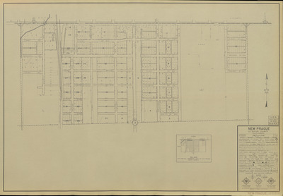
1936
County
Le Sueur, Scott
Scale
1:24000
Coordinates
(W 93°35'14"-W 93°33'46"/N 44°32'37"-N 44°32'10")
Project No.
M.W.P.A. Project No. 5259
Notes
Printed note on front reads "Note for full corporate limits see New Prague Scott County."
Description
[1936] city plat maps completed by the Minnesota Works Progress Administration under the supervision of the Minnesota Department of Highways.
Physical Format
City Plat Map
Dimensions
62 x 92 cm
Item Type
Cartographic
Collection Name
Minnesota Works Progress Administration City Plat Maps, [1936]
Contributing Organization
Dr. Mary T. Dooley Map Library, Memorial Library, Minnesota State University, Mankato, P.O. Box 8419, Mankato, MN 56002-8419
Contact Information
Dr. Mary T. Dooley Map Library, Memorial Library, Minnesota State University, Mankato, P.O. Box 8419, Mankato, MN 56002-8419
Creative Commons License

This work is licensed under a Creative Commons Attribution-NonCommercial 4.0 International License
Scanning Center
Dr. Mary T. Dooley Map Library, Memorial Library, Minnesota State University, Mankato, P.O. Box 8419, Mankato, MN 56002-8419
Object File Name
MWPA_1936_New_Prague_Sheet01.tif
Date Digital
2025-05-23
Item Digital Format
Image/tiff
Master File Format
Image/tiff
Master File Size
901308872
Master File Bit Depth
24
Master File Resolution
600 dpi
Master File Width
20772
Master File Height
14450
Master File Hardware
Zeutschel OS C1
Master File Software
OmniScan Software OS12
Master File System
Windows 11
Master File Checksum
475732973a99620b4bc089b470651eb8
Keywords
minnesota works progress administration, mwpa, wpa, 1936, new prague, golf course, golf links, park, railroad

