

Preview
Flight Code
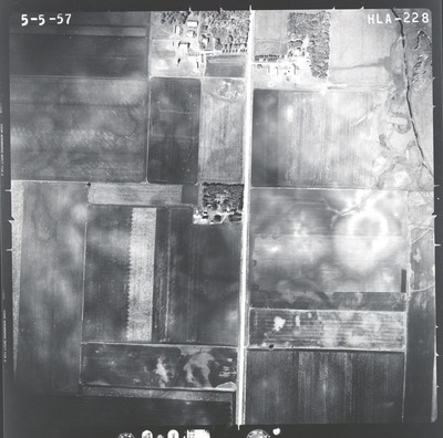
HLA
Date Flown
Spring 5-5-1957
Aerial Survey Project No. (A.S.P. No.)
57-6, 6A
County
Martin
Trunk Highway (T.H.)
[I-90]
Location
[From Welcome to Fairmont]
Center Latitude
43°40'23.37"N
Center Longitude
94°30'4.95"W
Scale
1’’=400’
Flight Height
2400
State Project No.
4609-07
Lens Serial Number
XF 6750
Focal Length
154.119 mm
Physical Format
Black and White Physical Aerial Photograph
Dimensions
9 x 9
Item Type
Still Image
Collection Name
Minnesota Department of Transportation District 7 Air Photo Collection, 1957-2006
Contributing Organization
Dr. Mary T. Dooley Map Library, Memorial Library, Minnesota State University, Mankato, P.O. Box 8419, Mankato, MN 56002-8419
Contact Information
Dr. Mary T. Dooley Map Library, Memorial Library, Minnesota State University, Mankato, P.O. Box 8419, Mankato, MN 56002-8419
Creative Commons License

This work is licensed under a Creative Commons Attribution-NonCommercial 4.0 International License
Scanning Center
Dr. Mary T. Dooley Map Library, Memorial Library, Minnesota State University, Mankato, P.O. Box 8419, Mankato, MN 56002-8419
Object File Name
MnDOT_1957_57-6, 6A_HLA-228.tif
Date Digital
2021-12-14
Item Digital Format
Image/tiff
Master File Format
Image/tiff
Master File Size
97567886
Master File Bit Depth
24
Master File Resolution
800 dpi
Master File Width
7664
Master File Height
7594
Master File Hardware
Epson Expression 10000XL
Master File Software
VueScan
Master File System
Windows 10
Master File Checksum
c28c8b51fedfc58bd658d626b5a15e1c
Keywords
mndot, air photos, aerial photography, 1957, lily creek, flight instruments

