

Preview
Flight Code
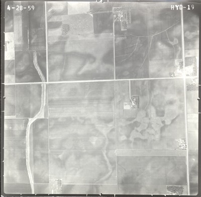
HYD
Date Flown
Spring 4-28-1959
Aerial Survey Project No. (A.S.P. No.)
59-16
County
Faribault
Trunk Highway (T.H.)
I-90
Location
4 mi. W. to Blue Earth
Center Latitude
43°39'54.72"N
Center Longitude
94°10'27.91"W
Scale
1’’=800’
Flight Height
4800
Work Order No.
3
Agreement No.
0-2249
Statewide Project No.
59
State Project No.
2280-01
Focal Length
154.119 mm
Physical Format
Black and White Physical Aerial Photograph
Dimensions
9 x 9
Item Type
Still Image
Collection Name
Minnesota Department of Transportation District 7 Air Photo Collection, 1957-2006
Contributing Organization
Dr. Mary T. Dooley Map Library, Memorial Library, Minnesota State University, Mankato, P.O. Box 8419, Mankato, MN 56002-8419
Contact Information
Dr. Mary T. Dooley Map Library, Memorial Library, Minnesota State University, Mankato, P.O. Box 8419, Mankato, MN 56002-8419
Creative Commons License

This work is licensed under a Creative Commons Attribution-NonCommercial 4.0 International License
Scanning Center
Dr. Mary T. Dooley Map Library, Memorial Library, Minnesota State University, Mankato, P.O. Box 8419, Mankato, MN 56002-8419
Object File Name
MnDOT_1959_59-16_HYD-19.tif
Date Digital
2021-01-11
Item Digital Format
Image/tiff
Master File Format
Image/tiff
Master File Size
106791758
Master File Bit Depth
24
Master File Resolution
800 dpi
Master File Width
7515
Master File Height
7356
Master File Hardware
Epson Expression 10000XL
Master File Software
VueScan
Master File System
Windows 10
Master File Checksum
69e8713e791ace0a988e7e43dca83838
Keywords
mndot, air photos, aerial photography, 1959, ditch

