

Preview
Flight Code
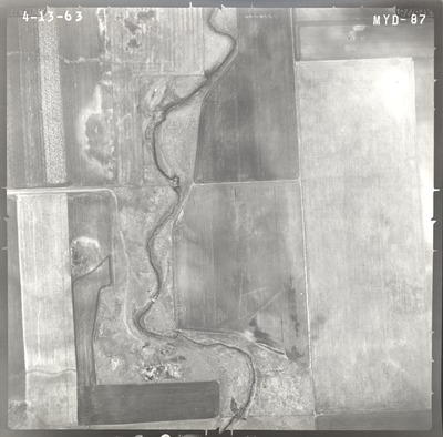
MYD
Date Flown
Spring 4-13-1963
Aerial Survey Project No. (A.S.P. No.)
61-63
County
Jackson
Trunk Highway (T.H.)
I-90
Location
Interchange of TH 90 with Co. Road 9
Center Latitude
43°38'12.43"N
Center Longitude
95°18'14.64"W
Scale
1''=250'
Flight Height
1500
Work Order No.
66
Agreement No.
52998
Statewide Project No.
62
State Project No.
3280
Lens Serial Number
XF 6778
Focal Length
152.848 mm
Physical Format
Black and White Physical Aerial Photograph
Dimensions
9 x 9
Item Type
Still Image
Collection Name
Minnesota Department of Transportation District 7 Air Photo Collection, 1957-2006
Contributing Organization
Dr. Mary T. Dooley Map Library, Memorial Library, Minnesota State University, Mankato, P.O. Box 8419, Mankato, MN 56002-8419
Contact Information
Dr. Mary T. Dooley Map Library, Memorial Library, Minnesota State University, Mankato, P.O. Box 8419, Mankato, MN 56002-8419
Creative Commons License

This work is licensed under a Creative Commons Attribution-NonCommercial 4.0 International License
Scanning Center
Dr. Mary T. Dooley Map Library, Memorial Library, Minnesota State University, Mankato, P.O. Box 8419, Mankato, MN 56002-8419
Object File Name
MnDOT_1963_61-63_MYD-87.tif
Date Digital
2021-01-26
Item Digital Format
Image/tiff
Master File Format
Image/tiff
Master File Size
109657454
Master File Bit Depth
24
Master File Resolution
800 dpi
Master File Width
7547
Master File Height
7438
Master File Hardware
Epson Expression 10000XL
Master File Software
VueScan
Master File System
Windows 10
Master File Checksum
2d2fb851c735c540cb0ef9d206e7418e
Keywords
mndot, air photos, aerial photography, 1963, stream

