

Preview
Flight Code
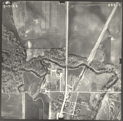
ARR
Date Flown
Spring 5-5-1966
Aerial Survey Project No. (A.S.P. No.)
65-37
County
Faribault
Trunk Highway (T.H.)
16
Location
Jct. TH 169 and TH 16
Center Latitude
43°38'39.64"N
Center Longitude
94° 6'58.54"W
Scale
1’’=400’
Flight Height
2400
Work Order No.
32
Agreement No.
54679
Statewide Project No.
65
State Project No.
2201
Focal Length
152.57 mm
Physical Format
Black and White Physical Aerial Photograph
Dimensions
9 x 9
Item Type
Still Image
Collection Name
Minnesota Department of Transportation District 7 Air Photo Collection, 1957-2006
Contributing Organization
Dr. Mary T. Dooley Map Library, Memorial Library, Minnesota State University, Mankato, P.O. Box 8419, Mankato, MN 56002-8419
Contact Information
Dr. Mary T. Dooley Map Library, Memorial Library, Minnesota State University, Mankato, P.O. Box 8419, Mankato, MN 56002-8419
Creative Commons License

This work is licensed under a Creative Commons Attribution-NonCommercial 4.0 International License
Scanning Center
Dr. Mary T. Dooley Map Library, Memorial Library, Minnesota State University, Mankato, P.O. Box 8419, Mankato, MN 56002-8419
Object File Name
MnDOT_1966_65-37_ARR-6.tif
Date Digital
2021-05-11
Item Digital Format
Image/tiff
Master File Format
Image/tiff
Master File Size
94774460
Master File Bit Depth
24
Master File Resolution
800 dpi
Master File Width
7573
Master File Height
7421
Master File Hardware
Epson Expression 10000XL
Master File Software
VueScan
Master File System
Windows 10
Master File Checksum
cf576d0b8161a7352f0b23fc94591da6
Keywords
mndot, air photos, aerial photography, 1966, blue earth, blue earth river, badger creek, railroad

