

Preview
Flight Code
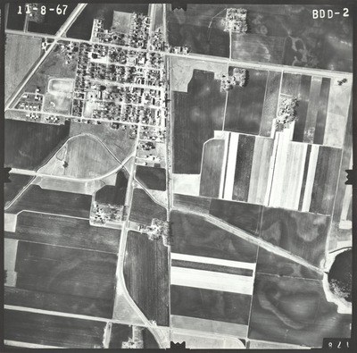
BDD
Date Flown
Fall 11-8-1967
Aerial Survey Project No. (A.S.P. No.)
67F-38
County
Nicollet
Trunk Highway (T.H.)
14
Location
From Jct. TH 15 to Nicollet
Center Latitude
44°16'43.32"N
Center Longitude
94°10'51.77"W
Scale
1''=800'
Flight Height
4800
Work Order No.
17
Agreement No.
55392
State Project No.
5202
Focal Length
152.35 mm
Physical Format
Black and White Physical Aerial Photograph
Dimensions
9 x 9
Item Type
Still Image
Collection Name
Minnesota Department of Transportation District 7 Air Photo Collection, 1957-2006
Contributing Organization
Dr. Mary T. Dooley Map Library, Memorial Library, Minnesota State University, Mankato, P.O. Box 8419, Mankato, MN 56002-8419
Contact Information
Dr. Mary T. Dooley Map Library, Memorial Library, Minnesota State University, Mankato, P.O. Box 8419, Mankato, MN 56002-8419
Creative Commons License

This work is licensed under a Creative Commons Attribution-NonCommercial 4.0 International License
Scanning Center
Dr. Mary T. Dooley Map Library, Memorial Library, Minnesota State University, Mankato, P.O. Box 8419, Mankato, MN 56002-8419
Object File Name
MnDOT_1967_67F-38_BDD-2.tif
Date Digital
2021-06-10
Item Digital Format
Image/tiff
Master File Format
Image/tiff
Master File Size
96595448
Master File Bit Depth
24
Master File Resolution
800 dpi
Master File Width
7536
Master File Height
7435
Master File Hardware
Epson Expression 10000XL
Master File Software
VueScan
Master File System
Windows 10
Master File Checksum
be4a79e0c36df5bb92798540c0fb2be1
Keywords
mndot, air photos, aerial photography, 1967, nicollet, middle lake, railroad, ditch, nicollet cemetery

