

Preview
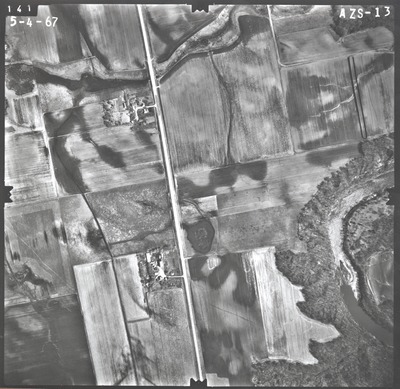
Flight Code
AZS
Date Flown
Spring 5-4-1967
Aerial Survey Project No. (A.S.P. No.)
67S-46
County
Blue Earth
Trunk Highway (T.H.)
169
Location
South Blue Earth Co. Line to Jct. TH 60
Center Latitude
44° 6'27.21"N
Center Longitude
94° 7'57.58"W
Scale
1''=500'
Flight Height
3000
Work Order No.
91
Agreement No.
54679
State Project No.
0712
Focal Length
152.35 mm
Physical Format
Black and White Physical Aerial Photograph
Dimensions
9 x 9
Item Type
Still Image
Collection Name
Minnesota Department of Transportation District 7 Air Photo Collection, 1957-2006
Contributing Organization
Dr. Mary T. Dooley Map Library, Memorial Library, Minnesota State University, Mankato, P.O. Box 8419, Mankato, MN 56002-8419
Contact Information
Dr. Mary T. Dooley Map Library, Memorial Library, Minnesota State University, Mankato, P.O. Box 8419, Mankato, MN 56002-8419
Creative Commons License

This work is licensed under a Creative Commons Attribution-NonCommercial 4.0 International License
Scanning Center
Dr. Mary T. Dooley Map Library, Memorial Library, Minnesota State University, Mankato, P.O. Box 8419, Mankato, MN 56002-8419
Object File Name
MnDOT_1967_67S-46_AZS-13.tif
Date Digital
2021-06-15
Item Digital Format
Image/tiff
Master File Format
Image/tiff
Master File Size
106207774
Master File Bit Depth
24
Master File Resolution
800 dpi
Master File Width
7579
Master File Height
7369
Master File Hardware
Epson Expression 10000XL
Master File Software
VueScan
Master File System
Windows 10
Master File Checksum
2846415990eb3f5128f15a147f3e02d3
Keywords
mndot, air photos, aerial photography, 1967, blue earth river, stream

