

Preview
Flight Code
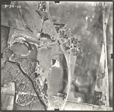
BGI
Date Flown
Spring 3-29-1968
Aerial Survey Project No. (A.S.P. No.)
68S-39
County
Faribault
Trunk Highway (T.H.)
169
Location
South Faribault Co. Line to N. Co. Line
Center Latitude
43°39'25.27"N
Center Longitude
94° 6'17.38"W
Scale
1''=500'
Flight Height
3000
Notes
Notes on front include "vis" handwritten twice with arrows. Symbols include 11 hand-drawn triangles with dots in the center.
Work Order No.
41
Agreement No.
55392
State Project No.
2207, 2208
Focal Length
152.43 mm
Physical Format
Black and White Physical Aerial Photograph
Dimensions
9 x 9
Item Type
Still Image
Collection Name
Minnesota Department of Transportation District 7 Air Photo Collection, 1957-2006
Contributing Organization
Dr. Mary T. Dooley Map Library, Memorial Library, Minnesota State University, Mankato, P.O. Box 8419, Mankato, MN 56002-8419
Contact Information
Dr. Mary T. Dooley Map Library, Memorial Library, Minnesota State University, Mankato, P.O. Box 8419, Mankato, MN 56002-8419
Creative Commons License

This work is licensed under a Creative Commons Attribution-NonCommercial 4.0 International License
Scanning Center
Dr. Mary T. Dooley Map Library, Memorial Library, Minnesota State University, Mankato, P.O. Box 8419, Mankato, MN 56002-8419
Object File Name
MnDOT_1968_68S-39_BGI-70.tif
Date Digital
2021-12-20
Item Digital Format
Image/tiff
Master File Format
Image/tiff
Master File Size
101384868
Master File Bit Depth
24
Master File Resolution
800 dpi
Master File Width
7531
Master File Height
7427
Master File Hardware
Epson Expression 10000XL
Master File Software
VueScan
Master File System
Windows 10
Master File Checksum
0278b705df5bc9a330ee3d560268d7ce
Keywords
mndot, air photos, aerial photography, 1968, blue earth, blue earth river, railroad, pond

