

Preview
Flight Code
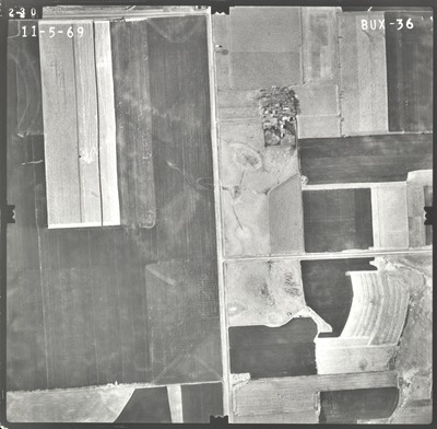
BUX
Date Flown
Fall 11-5-1969
Aerial Survey Project No. (A.S.P. No.)
69F-10
County
Waseca
Trunk Highway (T.H.)
14
Location
6 mi. W. of Waseca to E. Co. Line
Center Latitude
44° 3'56.77"N
Center Longitude
93°34'43.59"W
Scale
1''=500'
Flight Height
3000
Work Order No.
13
Agreement No.
56113
State Project No.
8103, 8104
Focal Length
152.39 mm
Physical Format
Black and White Physical Aerial Photograph
Dimensions
9 x 9
Item Type
Still Image
Collection Name
Minnesota Department of Transportation District 7 Air Photo Collection, 1957-2006
Contributing Organization
Dr. Mary T. Dooley Map Library, Memorial Library, Minnesota State University, Mankato, P.O. Box 8419, Mankato, MN 56002-8419
Contact Information
Dr. Mary T. Dooley Map Library, Memorial Library, Minnesota State University, Mankato, P.O. Box 8419, Mankato, MN 56002-8419
Creative Commons License

This work is licensed under a Creative Commons Attribution-NonCommercial 4.0 International License
Scanning Center
Dr. Mary T. Dooley Map Library, Memorial Library, Minnesota State University, Mankato, P.O. Box 8419, Mankato, MN 56002-8419
Object File Name
MnDOT_1969_69F-10_BUX-36.tif
Date Digital
2021-08-03
Item Digital Format
Image/tiff
Master File Format
Image/tiff
Master File Size
99279902
Master File Bit Depth
24
Master File Resolution
800 dpi
Master File Width
7611
Master File Height
7453
Master File Hardware
Epson Expression 10000XL
Master File Software
VueScan
Master File System
Windows 10
Master File Checksum
233629cdddb46163e8a95404f53ecb3f
Keywords
mndot, air photos, aerial photography, 1969, marsh

