

Preview
Flight Code
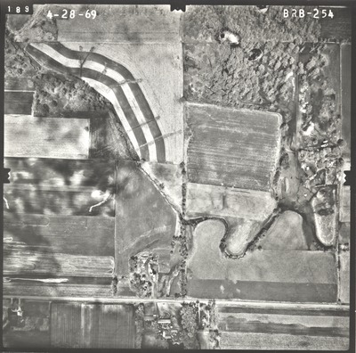
BRB
Date Flown
Spring 4-28-1969
Aerial Survey Project No. (A.S.P. No.)
69S-23
County
Le Sueur
Trunk Highway (T.H.)
112
Location
Le Sueur to Ottawa
Center Latitude
44°22'24.43"N
Center Longitude
93°53'57.31"W
Scale
1’’=400’
Flight Height
2400
Work Order No.
96
Agreement No.
55392
State Project No.
4011
Focal Length
152.46 mm
Physical Format
Black and White Physical Aerial Photograph
Dimensions
9 x 9
Item Type
Still Image
Collection Name
Minnesota Department of Transportation District 7 Air Photo Collection, 1957-2006
Contributing Organization
Dr. Mary T. Dooley Map Library, Memorial Library, Minnesota State University, Mankato, P.O. Box 8419, Mankato, MN 56002-8419
Contact Information
Dr. Mary T. Dooley Map Library, Memorial Library, Minnesota State University, Mankato, P.O. Box 8419, Mankato, MN 56002-8419
Creative Commons License

This work is licensed under a Creative Commons Attribution-NonCommercial 4.0 International License
Scanning Center
Dr. Mary T. Dooley Map Library, Memorial Library, Minnesota State University, Mankato, P.O. Box 8419, Mankato, MN 56002-8419
Object File Name
MnDOT_1969_69S-23_BRB-254.tif
Date Digital
2021-08-10
Item Digital Format
Image/tiff
Master File Format
Image/tiff
Master File Size
101576314
Master File Bit Depth
24
Master File Resolution
800 dpi
Master File Width
7547
Master File Height
7467
Master File Hardware
Epson Expression 10000XL
Master File Software
VueScan
Master File System
Windows 10
Master File Checksum
537054f35150598cd614fb795731e178
Keywords
mndot, air photos, aerial photography, 1969, stream

