

Preview
Flight Code
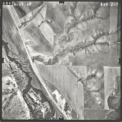
BRK
Date Flown
Spring 4-29-1969
Aerial Survey Project No. (A.S.P. No.)
69S-24
County
Jackson
Trunk Highway (T.H.)
16, 71
Location
South State Line to N. Jct. TH 71 and TH 16 Jackson
Center Latitude
43°35'29.61"N
Center Longitude
94°58'20.19"W
Scale
1’’=400’
Flight Height
2400
Work Order No.
96
Agreement No.
55392
State Project No.
3202, 3205
Focal Length
152.46 mm
Physical Format
Black and White Physical Aerial Photograph
Dimensions
9 x 9
Item Type
Still Image
Collection Name
Minnesota Department of Transportation District 7 Air Photo Collection, 1957-2006
Contributing Organization
Dr. Mary T. Dooley Map Library, Memorial Library, Minnesota State University, Mankato, P.O. Box 8419, Mankato, MN 56002-8419
Contact Information
Dr. Mary T. Dooley Map Library, Memorial Library, Minnesota State University, Mankato, P.O. Box 8419, Mankato, MN 56002-8419
Creative Commons License

This work is licensed under a Creative Commons Attribution-NonCommercial 4.0 International License
Scanning Center
Dr. Mary T. Dooley Map Library, Memorial Library, Minnesota State University, Mankato, P.O. Box 8419, Mankato, MN 56002-8419
Object File Name
MnDOT_1969_69S-24_BRK-207.tif
Date Digital
2021-08-11
Item Digital Format
Image/tiff
Master File Format
Image/tiff
Master File Size
109360386
Master File Bit Depth
24
Master File Resolution
800 dpi
Master File Width
7584
Master File Height
7557
Master File Hardware
Epson Expression 10000XL
Master File Software
VueScan
Master File System
Windows 10
Master File Checksum
b8c949b866a1ff765276456d8cb8ef2f
Keywords
mndot, air photos, aerial photography, 1969, des moines river, stream, gravel pit

