

Preview
Flight Code
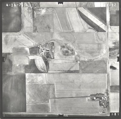
BXX
Date Flown
Spring 4-16-1970
Aerial Survey Project No. (A.S.P. No.)
70S-34
County
Jackson
Trunk Highway (T.H.)
I-90
Location
Proposed Rest Area Site at Clear Lake W. of Jackson
Center Latitude
43°38'28.70"N
Center Longitude
95° 4'52.50"W
Scale
1’’=400’
Flight Height
2400
Work Order No.
46
Agreement No.
56113
State Project No.
3280
Focal Length
152.39 mm
Physical Format
Black and White Physical Aerial Photograph
Dimensions
9 x 9
Item Type
Still Image
Collection Name
Minnesota Department of Transportation District 7 Air Photo Collection, 1957-2006
Contributing Organization
Dr. Mary T. Dooley Map Library, Memorial Library, Minnesota State University, Mankato, P.O. Box 8419, Mankato, MN 56002-8419
Contact Information
Dr. Mary T. Dooley Map Library, Memorial Library, Minnesota State University, Mankato, P.O. Box 8419, Mankato, MN 56002-8419
Creative Commons License

This work is licensed under a Creative Commons Attribution-NonCommercial 4.0 International License
Scanning Center
Dr. Mary T. Dooley Map Library, Memorial Library, Minnesota State University, Mankato, P.O. Box 8419, Mankato, MN 56002-8419
Object File Name
MnDOT_1970_70S-34_BXX-12.tif
Date Digital
2021-08-18
Item Digital Format
Image/tiff
Master File Format
Image/tiff
Master File Size
101523768
Master File Bit Depth
24
Master File Resolution
800 dpi
Master File Width
7664
Master File Height
7537
Master File Hardware
Epson Expression 10000XL
Master File Software
VueScan
Master File System
Windows 10
Master File Checksum
41a6ec295c1bc74d33d50ee269866c9c
Keywords
mndot, air photos, aerial photography, 1970, stream

