

Preview
Flight Code
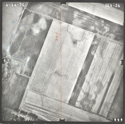
CGN
Date Flown
Spring 4-14-1971
Aerial Survey Project No. (A.S.P. No.)
71S-13
County
Watonwan
Trunk Highway (T.H.)
60
Location
From 1 mi. W. of W. Jct. TH 4 to 2 mi. E. of St. James
Center Latitude
43°57'38.35"N
Center Longitude
94°38'46.40"W
Scale
1''=250'
Flight Height
1500
Notes
Note on front includes a dotted orange line for road construction plans and handwritten "E.B.R." Symbols include arrows for flow direction and blue lines.
Work Order No.
105
Agreement No.
56113
State Project No.
8308, 8309
Focal Length
152.39 mm
Physical Format
Black and White Physical Aerial Photograph
Dimensions
9 x 9
Item Type
Still Image
Collection Name
Minnesota Department of Transportation District 7 Air Photo Collection, 1957-2006
Contributing Organization
Dr. Mary T. Dooley Map Library, Memorial Library, Minnesota State University, Mankato, P.O. Box 8419, Mankato, MN 56002-8419
Contact Information
Dr. Mary T. Dooley Map Library, Memorial Library, Minnesota State University, Mankato, P.O. Box 8419, Mankato, MN 56002-8419
Creative Commons License

This work is licensed under a Creative Commons Attribution-NonCommercial 4.0 International License
Scanning Center
Dr. Mary T. Dooley Map Library, Memorial Library, Minnesota State University, Mankato, P.O. Box 8419, Mankato, MN 56002-8419
Object File Name
MnDOT_1971_71S-13_CGN-26.tif
Date Digital
2021-08-20
Item Digital Format
Image/tiff
Master File Format
Image/tiff
Master File Size
107870792
Master File Bit Depth
24
Master File Resolution
800 dpi
Master File Width
7632
Master File Height
7557
Master File Hardware
Epson Expression 10000XL
Master File Software
VueScan
Master File System
Windows 10
Master File Checksum
b3283f4e6527412cb3c15826a2a9f61c
Keywords
mndot, air photos, aerial photography, 1971, saint james creek, drainage design

