

Preview
Flight Code
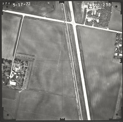
COD
Date Flown
Spring 5-17-1972
Aerial Survey Project No. (A.S.P. No.)
72S-65
County
Jackson
Trunk Highway (T.H.)
60
Location
Windom to Butterfield
Center Latitude
43°50'33.87"N
Center Longitude
95° 7'57.58"W
Scale
1''=250'
Flight Height
1500
Notes
Note on front includes pencil lines drawn down the center of the photo, both vertical and horizontal, to find the principal point.
Work Order No.
43
Agreement No.
56854
State Project No.
1703, 8308
Focal Length
152.36 mm
Physical Format
Black and White Physical Aerial Photograph
Dimensions
9 x 9
Item Type
Still Image
Collection Name
Minnesota Department of Transportation District 7 Air Photo Collection, 1957-2006
Contributing Organization
Dr. Mary T. Dooley Map Library, Memorial Library, Minnesota State University, Mankato, P.O. Box 8419, Mankato, MN 56002-8419
Contact Information
Dr. Mary T. Dooley Map Library, Memorial Library, Minnesota State University, Mankato, P.O. Box 8419, Mankato, MN 56002-8419
Creative Commons License

This work is licensed under a Creative Commons Attribution-NonCommercial 4.0 International License
Scanning Center
Dr. Mary T. Dooley Map Library, Memorial Library, Minnesota State University, Mankato, P.O. Box 8419, Mankato, MN 56002-8419
Object File Name
MnDOT_1972_72S-65_COD-230.tif
Date Digital
2021-10-10
Item Digital Format
Image/tiff
Master File Format
Image/tiff
Master File Size
93367622
Master File Bit Depth
24
Master File Resolution
800 dpi
Master File Width
7509
Master File Height
7469
Master File Hardware
Epson Expression 10000XL
Master File Software
VueScan
Master File System
Windows 10
Master File Checksum
e39a5c5a2e2cdab3ee9f5306b012cd85
Keywords
mndot, air photos, aerial photography, 1972, railroad

