

Preview
Flight Code
CXO
Date Flown
Spring 4-23-1973
Aerial Survey Project No. (A.S.P. No.)
73S-14
County
Blue Earth
Trunk Highway (T.H.)
14
Location
Front St. in Mankato to Eagle Lake
Center Latitude
44°10'7.09"N
Center Longitude
93°59'6.59"W
Scale
1''=250'
Flight Height
1500
Notes
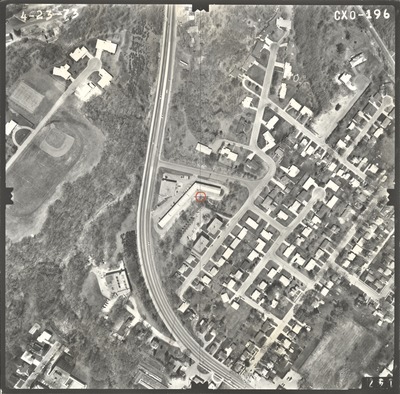
Note on front includes pencil lines drawn down the center of the photo, both vertical and horizontal, to find the principal point. There is a hand-drawn orange circle indicating the principal point and another pencil line extending from the center.
Work Order No.
95
Agreement No.
56854
State Project No.
0702
Focal Length
152.36 mm
Physical Format
Black and White Physical Aerial Photograph
Dimensions
9 x 9
Item Type
Still Image
Collection Name
Minnesota Department of Transportation District 7 Air Photo Collection, 1957-2006
Contributing Organization
Dr. Mary T. Dooley Map Library, Memorial Library, Minnesota State University, Mankato, P.O. Box 8419, Mankato, MN 56002-8419
Contact Information
Dr. Mary T. Dooley Map Library, Memorial Library, Minnesota State University, Mankato, P.O. Box 8419, Mankato, MN 56002-8419
Creative Commons License

This work is licensed under a Creative Commons Attribution-NonCommercial 4.0 International License
Scanning Center
Dr. Mary T. Dooley Map Library, Memorial Library, Minnesota State University, Mankato, P.O. Box 8419, Mankato, MN 56002-8419
Object File Name
MnDOT_1973_73S-14_CXO-196.tif
Date Digital
2021-10-10
Item Digital Format
Image/tiff
Master File Format
Image/tiff
Master File Size
99635058
Master File Bit Depth
24
Master File Resolution
800 dpi
Master File Width
7584
Master File Height
7479
Master File Hardware
Epson Expression 10000XL
Master File Software
VueScan
Master File System
Windows 10
Master File Checksum
31468a024612f5d2f06b2f974d2f7b75
Keywords
mndot, air photos, aerial photography, 1973, mankato

