

Preview
Flight Code
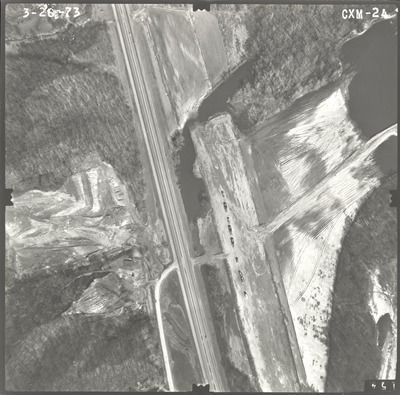
CXM
Date Flown
Spring 3-26-1973
Aerial Survey Project No. (A.S.P. No.)
73S-30
County
Blue Earth, Nicollet
Trunk Highway (T.H.)
14
Location
Co. Road 13 to Minnesota River in North Mankato
Center Latitude
44°12'2.47"N
Center Longitude
94° 1'17.31"W
Scale
1''=250'
Flight Height
1500
Work Order No.
95
Agreement No.
56854
State Project No.
5203-44
Focal Length
152.36 mm
Physical Format
Black and White Physical Aerial Photograph
Dimensions
9 x 9
Item Type
Still Image
Collection Name
Minnesota Department of Transportation District 7 Air Photo Collection, 1957-2006
Contributing Organization
Dr. Mary T. Dooley Map Library, Memorial Library, Minnesota State University, Mankato, P.O. Box 8419, Mankato, MN 56002-8419
Contact Information
Dr. Mary T. Dooley Map Library, Memorial Library, Minnesota State University, Mankato, P.O. Box 8419, Mankato, MN 56002-8419
Creative Commons License

This work is licensed under a Creative Commons Attribution-NonCommercial 4.0 International License
Scanning Center
Dr. Mary T. Dooley Map Library, Memorial Library, Minnesota State University, Mankato, P.O. Box 8419, Mankato, MN 56002-8419
Object File Name
MnDOT_1973_73S-30_CXM-24.tif
Date Digital
2021-10-25
Item Digital Format
Image/tiff
Master File Format
Image/tiff
Master File Size
95534104
Master File Bit Depth
24
Master File Resolution
800 dpi
Master File Width
7520
Master File Height
7431
Master File Hardware
Epson Expression 10000XL
Master File Software
VueScan
Master File System
Windows 10
Master File Checksum
a5c9f2e6cdc044db01b1d81eb6ee2f11
Keywords
mndot, air photos, aerial photography, 1973, minnesota river, road construction

