

Preview
Flight Code
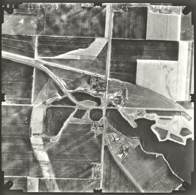
DXZ
Date Flown
Fall 11-14-1975
Aerial Survey Project No. (A.S.P. No.)
75F-21
County
Watonwan
Trunk Highway (T.H.)
60
Location
St. James Bypass
Center Latitude
43°57'50.01"N
Center Longitude
94°39'38.31"W
Scale
1’’=800’
Flight Height
4800
Work Order No.
18
Agreement No.
57995
State Project No.
8303, 8309
Focal Length
152.36 mm
Physical Format
Black and White Physical Aerial Photograph
Dimensions
9 x 9
Item Type
Still Image
Collection Name
Minnesota Department of Transportation District 7 Air Photo Collection, 1957-2006
Contributing Organization
Dr. Mary T. Dooley Map Library, Memorial Library, Minnesota State University, Mankato, P.O. Box 8419, Mankato, MN 56002-8419
Contact Information
Dr. Mary T. Dooley Map Library, Memorial Library, Minnesota State University, Mankato, P.O. Box 8419, Mankato, MN 56002-8419
Creative Commons License

This work is licensed under a Creative Commons Attribution-NonCommercial 4.0 International License
Scanning Center
Dr. Mary T. Dooley Map Library, Memorial Library, Minnesota State University, Mankato, P.O. Box 8419, Mankato, MN 56002-8419
Object File Name
MnDOT_1975_75F-21_DXZ-7.tif
Date Digital
2021-11-01
Item Digital Format
Image/tiff
Master File Format
Image/tiff
Master File Size
101750310
Master File Bit Depth
24
Master File Resolution
800 dpi
Master File Width
7520
Master File Height
7462
Master File Hardware
Epson Expression 10000XL
Master File Software
VueScan
Master File System
Windows 10
Master File Checksum
7a24d7f02871cb28fdbb07d56d9ed723
Keywords
mndot, air photos, aerial photography, 1975, saint james lake, stream, marsh, field tiling

