

Preview
Flight Code
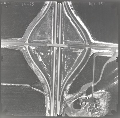
DXY
Date Flown
Fall 11-14-1975
Aerial Survey Project No. (A.S.P. No.)
75F-23
County
Jackson
Trunk Highway (T.H.)
I-90
Location
From Co. Road 9 to TH 4 N. of Sherburn
Center Latitude
43°39'10.11"N
Center Longitude
94°52'26.19"W
Scale
1''=250'
Flight Height
1500
Work Order No.
18
Agreement No.
57995
State Project No.
3280, 4680
Focal Length
152.36 mm
Physical Format
Black and White Physical Aerial Photograph
Dimensions
9 x 9
Item Type
Still Image
Collection Name
Minnesota Department of Transportation District 7 Air Photo Collection, 1957-2006
Contributing Organization
Dr. Mary T. Dooley Map Library, Memorial Library, Minnesota State University, Mankato, P.O. Box 8419, Mankato, MN 56002-8419
Contact Information
Dr. Mary T. Dooley Map Library, Memorial Library, Minnesota State University, Mankato, P.O. Box 8419, Mankato, MN 56002-8419
Creative Commons License

This work is licensed under a Creative Commons Attribution-NonCommercial 4.0 International License
Scanning Center
Dr. Mary T. Dooley Map Library, Memorial Library, Minnesota State University, Mankato, P.O. Box 8419, Mankato, MN 56002-8419
Object File Name
MnDOT_1975_75F-23_DXY-55.tif
Date Digital
2021-11-08
Item Digital Format
Image/tiff
Master File Format
Image/tiff
Master File Size
94560814
Master File Bit Depth
24
Master File Resolution
800 dpi
Master File Width
7573
Master File Height
7449
Master File Hardware
Epson Expression 10000XL
Master File Software
VueScan
Master File System
Windows 10
Master File Checksum
940274d503ce4609ef656663f0feadcf
Keywords
mndot, air photos, aerial photography, 1975, stream

