

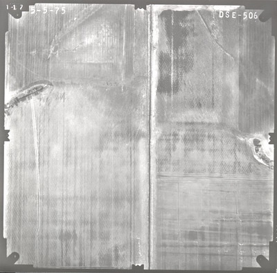
Preview
Flight Code
DSE
Date Flown
Spring 5-5-1975
Aerial Survey Project No. (A.S.P. No.)
75S-21
County
Faribault
Trunk Highway (T.H.)
I-90
Location
West Faribault Co. Line to Jct. TH 22
Center Latitude
43°40'10.67"N
Center Longitude
93°55'39.14"W
Scale
1''=250'
Flight Height
1500
Work Order No.
91
Agreement No.
57506
State Project No.
2280
Focal Length
152.36 mm
Physical Format
Black and White Physical Aerial Photograph
Dimensions
9 x 9
Item Type
Still Image
Collection Name
Minnesota Department of Transportation District 7 Air Photo Collection, 1957-2006
Contributing Organization
Dr. Mary T. Dooley Map Library, Memorial Library, Minnesota State University, Mankato, P.O. Box 8419, Mankato, MN 56002-8419
Contact Information
Dr. Mary T. Dooley Map Library, Memorial Library, Minnesota State University, Mankato, P.O. Box 8419, Mankato, MN 56002-8419
Creative Commons License

This work is licensed under a Creative Commons Attribution-NonCommercial 4.0 International License
Scanning Center
Dr. Mary T. Dooley Map Library, Memorial Library, Minnesota State University, Mankato, P.O. Box 8419, Mankato, MN 56002-8419
Object File Name
MnDOT_1975_75S-21_DSE-506.tif
Date Digital
2021-12-17
Item Digital Format
Image/tiff
Master File Format
Image/tiff
Master File Size
110134110
Master File Bit Depth
24
Master File Resolution
800 dpi
Master File Width
7584
Master File Height
7469
Master File Hardware
Epson Expression 10000XL
Master File Software
VueScan
Master File System
Windows 10
Master File Checksum
f4eeda46f363cc87e09f4ad5ddd63c69
Keywords
mndot, air photos, aerial photography, 1975, oza tanka lakebed, ditch

