

Preview
Flight Code
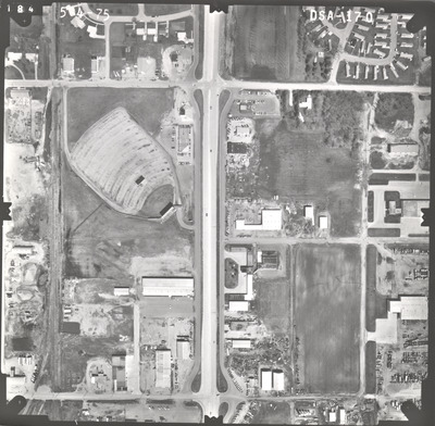
DSA
Date Flown
Spring 5-4-1975
Aerial Survey Project No. (A.S.P. No.)
75S-24
County
Martin
Trunk Highway (T.H.)
15
Location
Fairmont to S. Jct. TH 60
Center Latitude
43°39'52.47"N
Center Longitude
94°26'51.05"W
Scale
1''=250'
Flight Height
1500
Work Order No.
91
Agreement No.
57506
State Project No.
4604, 8303
Focal Length
152.36 mm
Physical Format
Black and White Physical Aerial Photograph
Dimensions
9 x 9
Item Type
Still Image
Collection Name
Minnesota Department of Transportation District 7 Air Photo Collection, 1957-2006
Contributing Organization
Dr. Mary T. Dooley Map Library, Memorial Library, Minnesota State University, Mankato, P.O. Box 8419, Mankato, MN 56002-8419
Contact Information
Dr. Mary T. Dooley Map Library, Memorial Library, Minnesota State University, Mankato, P.O. Box 8419, Mankato, MN 56002-8419
Creative Commons License

This work is licensed under a Creative Commons Attribution-NonCommercial 4.0 International License
Scanning Center
Dr. Mary T. Dooley Map Library, Memorial Library, Minnesota State University, Mankato, P.O. Box 8419, Mankato, MN 56002-8419
Object File Name
MnDOT_1975_75S-24_DSA-170.tif
Date Digital
2022-02-01
Item Digital Format
Image/tiff
Master File Format
Image/tiff
Master File Size
92902170
Master File Bit Depth
24
Master File Resolution
800 dpi
Master File Width
7531
Master File Height
7383
Master File Hardware
Epson Expression 10000XL
Master File Software
VueScan
Master File System
Windows 10
Master File Checksum
4b5ff45a3fa388d451c06b98c3d0fa3f
Keywords
mndot, air photos, aerial photography, 1975, fairmont, railroad, dirt pile

