

Preview
Flight Code
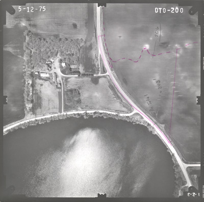
DTO
Date Flown
Spring 5-12-1975
Aerial Survey Project No. (A.S.P. No.)
75S-25
County
Sibley
Trunk Highway (T.H.)
15
Location
New Ulm to Winthrop
Center Latitude
44°30'7.22"N
Center Longitude
94°22'16.78"W
Scale
1''=250'
Flight Height
1500
Notes
Notes on front read "45 AC Total, 1"=243', 806." There is a pink outline of the area and arrows.
Work Order No.
91
Agreement No.
57506
State Project No.
5204, 7202
Focal Length
152.36 mm
Physical Format
Black and White Physical Aerial Photograph
Dimensions
9 x 9
Item Type
Still Image
Collection Name
Minnesota Department of Transportation District 7 Air Photo Collection, 1957-2006
Contributing Organization
Dr. Mary T. Dooley Map Library, Memorial Library, Minnesota State University, Mankato, P.O. Box 8419, Mankato, MN 56002-8419
Contact Information
Dr. Mary T. Dooley Map Library, Memorial Library, Minnesota State University, Mankato, P.O. Box 8419, Mankato, MN 56002-8419
Creative Commons License

This work is licensed under a Creative Commons Attribution-NonCommercial 4.0 International License
Scanning Center
Dr. Mary T. Dooley Map Library, Memorial Library, Minnesota State University, Mankato, P.O. Box 8419, Mankato, MN 56002-8419
Object File Name
MnDOT_1975_75S-25_DTO-200.tif
Date Digital
2022-02-27
Item Digital Format
Image/tiff
Master File Format
Image/tiff
Master File Size
96560622
Master File Bit Depth
24
Master File Resolution
800 dpi
Master File Width
7627
Master File Height
7555
Master File Hardware
Epson Expression 10000XL
Master File Software
VueScan
Master File System
Windows 10
Master File Checksum
649c78fdd1436dc9de0b318bc19dcb4e
Keywords
mndot, air photos, aerial photography, 1975, sand lake

