

Preview
Flight Code
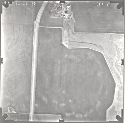
EFX
Date Flown
Fall 11-11-1976
Aerial Survey Project No. (A.S.P. No.)
76F-18
County
Sibley
Trunk Highway (T.H.)
22
Location
Bridge 4333 over Judicial Ditch 18, 1.2 mi. N. of Gaylord
Center Latitude
44°34'31.12"N
Center Longitude
94°13'26.46"W
Scale
1''=250'
Flight Height
1500
Work Order No.
9
Agreement No.
58318
State Project No.
7208-16
Focal Length
152.36 mm
Physical Format
Black and White Physical Aerial Photograph
Dimensions
9 x 9
Item Type
Still Image
Collection Name
Minnesota Department of Transportation District 7 Air Photo Collection, 1957-2006
Contributing Organization
Dr. Mary T. Dooley Map Library, Memorial Library, Minnesota State University, Mankato, P.O. Box 8419, Mankato, MN 56002-8419
Contact Information
Dr. Mary T. Dooley Map Library, Memorial Library, Minnesota State University, Mankato, P.O. Box 8419, Mankato, MN 56002-8419
Creative Commons License

This work is licensed under a Creative Commons Attribution-NonCommercial 4.0 International License
Scanning Center
Dr. Mary T. Dooley Map Library, Memorial Library, Minnesota State University, Mankato, P.O. Box 8419, Mankato, MN 56002-8419
Object File Name
MnDOT_1976_76F-18_EFX-7.tif
Date Digital
2022-03-21
Item Digital Format
Image/tiff
Master File Format
Image/tiff
Master File Size
93276418
Master File Bit Depth
24
Master File Resolution
800 dpi
Master File Width
7509
Master File Height
7387
Master File Hardware
Epson Expression 10000XL
Master File Software
VueScan
Master File System
Windows 10
Master File Checksum
94c485ae348dcd4562ea63c7a573e0b7
Keywords
mndot, air photos, aerial photography, 1976, marsh

