

Preview
Flight Code
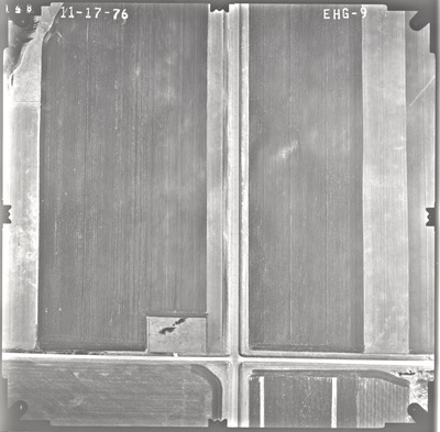
EHG
Date Flown
Fall 11-17-1976
Aerial Survey Project No. (A.S.P. No.)
76F-21
County
Cottonwood
Trunk Highway (T.H.)
62
Location
Bridge 3795 over Heron Lake Outlet 7.3 mi. W. of Windom
Center Latitude
43°51'44.63"N
Center Longitude
95°15'50.60"W
Scale
1''=250'
Flight Height
1500
Work Order No.
9
Agreement No.
58318
State Project No.
1704-16
Focal Length
152.36 mm
Physical Format
Black and White Physical Aerial Photograph
Dimensions
9 x 9
Item Type
Still Image
Collection Name
Minnesota Department of Transportation District 7 Air Photo Collection, 1957-2006
Contributing Organization
Dr. Mary T. Dooley Map Library, Memorial Library, Minnesota State University, Mankato, P.O. Box 8419, Mankato, MN 56002-8419
Contact Information
Dr. Mary T. Dooley Map Library, Memorial Library, Minnesota State University, Mankato, P.O. Box 8419, Mankato, MN 56002-8419
Creative Commons License

This work is licensed under a Creative Commons Attribution-NonCommercial 4.0 International License
Scanning Center
Dr. Mary T. Dooley Map Library, Memorial Library, Minnesota State University, Mankato, P.O. Box 8419, Mankato, MN 56002-8419
Object File Name
MnDOT_1976_76F-21_EHG-9.tif
Date Digital
2022-03-23
Item Digital Format
Image/tiff
Master File Format
Image/tiff
Master File Size
101498046
Master File Bit Depth
24
Master File Resolution
800 dpi
Master File Width
7520
Master File Height
7397
Master File Hardware
Epson Expression 10000XL
Master File Software
VueScan
Master File System
Windows 10
Master File Checksum
6e6bafc7d804f61d4ab4b02d0fe2ecd6
Keywords
mndot, air photos, aerial photography, 1976, springfield cemetery

