

Preview
Flight Code
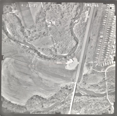
EMR
Date Flown
Spring 4-22-1977
Aerial Survey Project No. (A.S.P. No.)
77S-27
County
Brown
Trunk Highway (T.H.)
15
Location
Bridge 4750 over Cottonwood River 2.5 mi. S. of New Ulm
Center Latitude
44°17'2.60"N
Center Longitude
94°26'15.50"W
Scale
1''=250'
Flight Height
1500
Notes
Notes on front include hand-drawn pencil lines. Data reads "885, 890" with tick marks along the existing road. Note on back reads "1" = Approx. 280'."
Work Order No.
60
Agreement No.
58318
State Project No.
0805
Focal Length
152.47 mm
Physical Format
Black and White Physical Aerial Photograph
Dimensions
9 x 9
Item Type
Still Image
Collection Name
Minnesota Department of Transportation District 7 Air Photo Collection, 1957-2006
Contributing Organization
Dr. Mary T. Dooley Map Library, Memorial Library, Minnesota State University, Mankato, P.O. Box 8419, Mankato, MN 56002-8419
Contact Information
Dr. Mary T. Dooley Map Library, Memorial Library, Minnesota State University, Mankato, P.O. Box 8419, Mankato, MN 56002-8419
Creative Commons License

This work is licensed under a Creative Commons Attribution-NonCommercial 4.0 International License
Scanning Center
Dr. Mary T. Dooley Map Library, Memorial Library, Minnesota State University, Mankato, P.O. Box 8419, Mankato, MN 56002-8419
Object File Name
MnDOT_1977_77S-27_EMR-46.tif
Date Digital
2022-06-21
Item Digital Format
Image/tiff
Master File Format
Image/tiff
Master File Size
98638532
Master File Bit Depth
24
Master File Resolution
800 dpi
Master File Width
7573
Master File Height
7533
Master File Hardware
Epson Expression 10000XL
Master File Software
VueScan
Master File System
Windows 10
Master File Checksum
23a2d13b42fc374d95e0e09aba669c29
Keywords
mndot, air photos, aerial photography, 1977, new ulm, cottonwood river

