

Preview
Flight Code
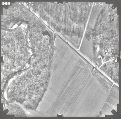
ELJ
Date Flown
Spring 4-9-1977
Aerial Survey Project No. (A.S.P. No.)
77S-30
County
Sibley
Trunk Highway (T.H.)
93
Location
Bridge 5355 over Rush River 2.0 mi. S. of Henderson
Center Latitude
44°30'9.74"N
Center Longitude
93°54'8.30"W
Scale
1''=250'
Flight Height
1500
Notes
Note on front includes a hand-drawn red "x" on the existing road.
Work Order No.
60
Agreement No.
58318
State Project No.
7212
Focal Length
153.13 mm
Physical Format
Black and White Physical Aerial Photograph
Dimensions
9 x 9
Item Type
Still Image
Collection Name
Minnesota Department of Transportation District 7 Air Photo Collection, 1957-2006
Contributing Organization
Dr. Mary T. Dooley Map Library, Memorial Library, Minnesota State University, Mankato, P.O. Box 8419, Mankato, MN 56002-8419
Contact Information
Dr. Mary T. Dooley Map Library, Memorial Library, Minnesota State University, Mankato, P.O. Box 8419, Mankato, MN 56002-8419
Creative Commons License

This work is licensed under a Creative Commons Attribution-NonCommercial 4.0 International License
Scanning Center
Dr. Mary T. Dooley Map Library, Memorial Library, Minnesota State University, Mankato, P.O. Box 8419, Mankato, MN 56002-8419
Object File Name
MnDOT_1977_77S-30_ELJ-54.tif
Date Digital
2022-06-22
Item Digital Format
Image/tiff
Master File Format
Image/tiff
Master File Size
105188498
Master File Bit Depth
24
Master File Resolution
800 dpi
Master File Width
7584
Master File Height
7513
Master File Hardware
Epson Expression 10000XL
Master File Software
VueScan
Master File System
Windows 10
Master File Checksum
6dbc1107a8f5d8632b174740eff255f9
Keywords
mndot, air photos, aerial photography, 1977, rush river

