

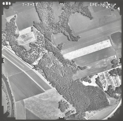
Preview
Flight Code
EPE
Date Flown
Summer 7-7-1977
Aerial Survey Project No. (A.S.P. No.)
77S-95
County
Brown, Nicollet
Trunk Highway (T.H.)
15
Location
New Ulm to Winthrop
Center Latitude
44°19'55.81"N
Center Longitude
94°26'29.40"W
Scale
1''=500'
Flight Height
3000
Work Order No.
82
Agreement No.
58318
State Project No.
5204-11, 7202-11
Focal Length
153.13 mm
Physical Format
Black and White Physical Aerial Photograph
Dimensions
9 x 9
Item Type
Still Image
Collection Name
Minnesota Department of Transportation District 7 Air Photo Collection, 1957-2006
Contributing Organization
Dr. Mary T. Dooley Map Library, Memorial Library, Minnesota State University, Mankato, P.O. Box 8419, Mankato, MN 56002-8419
Contact Information
Dr. Mary T. Dooley Map Library, Memorial Library, Minnesota State University, Mankato, P.O. Box 8419, Mankato, MN 56002-8419
Creative Commons License

This work is licensed under a Creative Commons Attribution-NonCommercial 4.0 International License
Scanning Center
Dr. Mary T. Dooley Map Library, Memorial Library, Minnesota State University, Mankato, P.O. Box 8419, Mankato, MN 56002-8419
Object File Name
MnDOT_1977_77S-95_EPE-70.tif
Date Digital
2022-07-21
Item Digital Format
Image/tiff
Master File Format
Image/tiff
Master File Size
101528826
Master File Bit Depth
24
Master File Resolution
800 dpi
Master File Width
7589
Master File Height
7454
Master File Hardware
Epson Expression 10000XL
Master File Software
VueScan
Master File System
Windows 10
Master File Checksum
434701d1405a29800b32dd69ec0d2b76
Keywords
mndot, air photos, aerial photography, 1977, minnesota river, stream, wetland

