

Preview
Flight Code
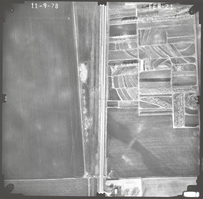
FEM
Date Flown
Fall 11-9-1978
Aerial Survey Project No. (A.S.P. No.)
78F-41
County
Faribault
Trunk Highway (T.H.)
169
Location
Bridge 3132 TH 169 over Co. Ditch 41 N. of Elmore
Center Latitude
43°31'27.06"N
Center Longitude
94° 5'13.49"W
Scale
1''=250'
Flight Height
1500
Notes
Note on front includes pencil lines drawn down the center of the photo, both vertical and horizontal, to find the principal point.
Work Order No.
19
Agreement No.
59194
State Project No.
2207-17
Focal Length
152.46 mm
Physical Format
Black and White Physical Aerial Photograph
Dimensions
9 x 9
Item Type
Still Image
Collection Name
Minnesota Department of Transportation District 7 Air Photo Collection, 1957-2006
Contributing Organization
Dr. Mary T. Dooley Map Library, Memorial Library, Minnesota State University, Mankato, P.O. Box 8419, Mankato, MN 56002-8419
Contact Information
Dr. Mary T. Dooley Map Library, Memorial Library, Minnesota State University, Mankato, P.O. Box 8419, Mankato, MN 56002-8419
Creative Commons License

This work is licensed under a Creative Commons Attribution-NonCommercial 4.0 International License
Scanning Center
Dr. Mary T. Dooley Map Library, Memorial Library, Minnesota State University, Mankato, P.O. Box 8419, Mankato, MN 56002-8419
Object File Name
MnDOT_1978_78F-41_FEM-21.tif
Date Digital
2022-07-22
Item Digital Format
Image/tiff
Master File Format
Image/tiff
Master File Size
100129880
Master File Bit Depth
24
Master File Resolution
800 dpi
Master File Width
7579
Master File Height
7433
Master File Hardware
Epson Expression 10000XL
Master File Software
VueScan
Master File System
Windows 10
Master File Checksum
00793ba8ad9825a3a8a6d56959ff4f58
Keywords
mndot, air photos, aerial photography, 1978

